
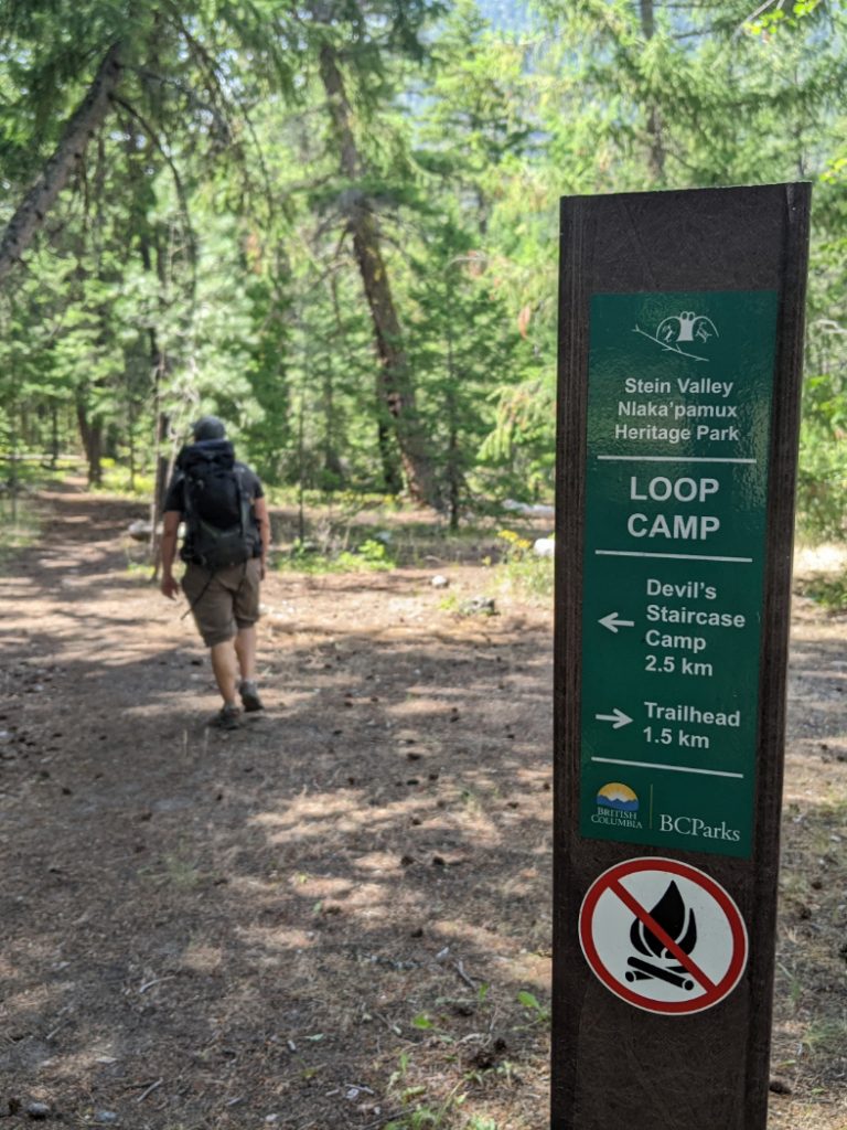
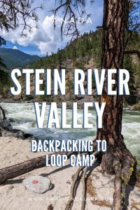
Lower Stein Valley to Loop Camp
The Lower Stein Valley is a 26km trail alongside the Stein River. It does have some elevation gains and losses, but this lower section is not particularly strenuous. The first campground, Loop Camp is less than 2km along the trail, so great for beginner backpackers. Stein Valley Nlaka’pamux Heritage Park has to be one of the most special (and unique) areas to hike in BC.
This trail was closed for several years, but opened in May 2022. We visited on Canada Day weekend (early July) when we were unable to secure reservations to go camping closer to Vancouver. Soon after our visit, the park was closed again due to the Nohomin Creek wildfire. You can check here or here to see if it has re-opened. I hope there was not too much damage and that this spectacular trail will be open again soon.
Why is the Stein Valley Special?
Stein Valley is the ancestral and spiritual home of the Nlaka’pamux people. The valley has some traditional power spots that were (and are still) used as the location for spiritual rituals. There are multiple rock-art sites as this watershed has the largest concentration of pictographs in Canada.
Stein Valley Nlaka’pamux Heritage Park is also the largest unlogged watershed in southwestern BC. The area was protected from logging by the local Nlaka’pamux people (from the Lytton First Nation) who worked with other first nations and environmentalists until the area was formally made into a Provincial Park in 1995. The park contains 3 glaciers and a whole range of special ecosystems from alpine meadows and large lakes to dry, open ponderosa pine forests; This means over 1000 square kilometers of watershed are protected.
Getting to the Stein Valley
Normally this is a 3.5-4 hour road trip from Vancouver. The Stein Valley is located 270km from Vancouver, close to Lytton. Be prepared for the devastation left by the heat dome and resulting fire that completely destroyed Lytton in 2021, it is heartbreaking to see the wreckage. From Lytton, there are three ways to get to the opposite side of the Fraser River:
- The free reaction ferry: At Lytton turn left onto Lytton Ferry Road and follow it down to ferry. It’s a small boat that can carry two cars. It uses the Fraser River’s current to propel it accross the river. It operated from 5:30am-9:50pm.
- Drive the long way; Go up to Lillooet, then drive down Texas Creek Road. You don’t need 4×4, but it is slow going, at least 2.5 hours (120km)
- Park and hike in, using either the rail bridge to the south of Lytton and then an 8km hike up to the park trailhead or the Fraser River Suspension Bridge and a 2km hike.


Sometime the reaction ferry is closed due to high waters in the Fraser River. I couldn’t find any notices about this online, and as Taryn’s book mentions it is often closed in late May, we figured we’d be okay in July. We were wrong. I didn’t have any phone signal, and we didn’t know about the nearby pedestrian bridges. So we opted to drive the long way via Lillooet and Texas Creek Road.

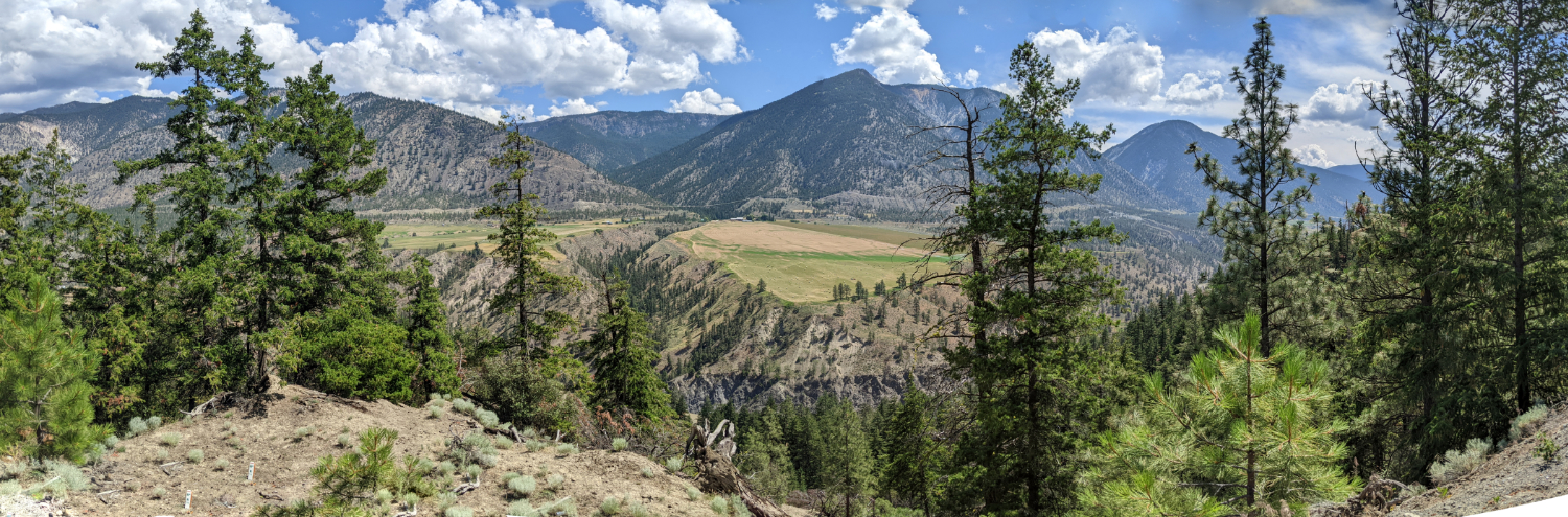
This road was incredible! It wibbles along the top edge of the Fraser Canyon giving fantastic views of the river on one side, and rugged farmland on the other. We even saw a herd of seemly wild horses!
Lower Stein Valley Map – Loop Camp
Purple shows the trail to Loop Camp, red shows the rest of our route. Or view my Strava map.
Lower Stein Valley to Loop Camp – the basics
Distance: 3.5km
Elevation gain: 90m
Time: 1-1.5 hours
What to bring: If you are backpacking, bring all your camping gear. The 10 Essentials.
Facilities: Loos and gorgeous arbor/picnic shelter at the parking lot.
The campsite has pit toilets and metal lockers for bear cache.
Dogs: Dogs are allowed on a leash
How hard is it? Easy to Loop Camp

It was good to see the facilities at the trail head, including the beautiful arbor that is used as a meeting place. Stein Valley Nlaka’pamux Heritage Park is jointly managed by the Lytton First Nation and the BC Provincial Government. The information boards and signs are written by local people and give you a chance to learn about the history/culture of this sacred area.
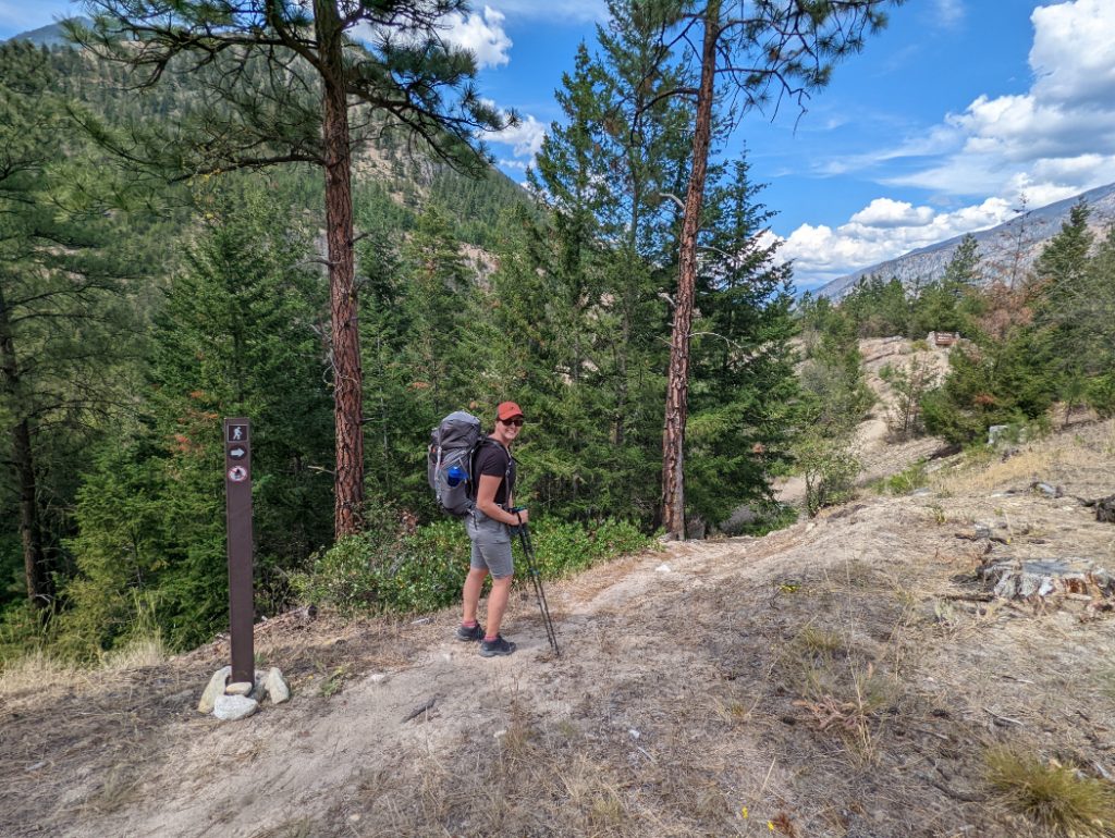
Lower Stein Valley – getting started
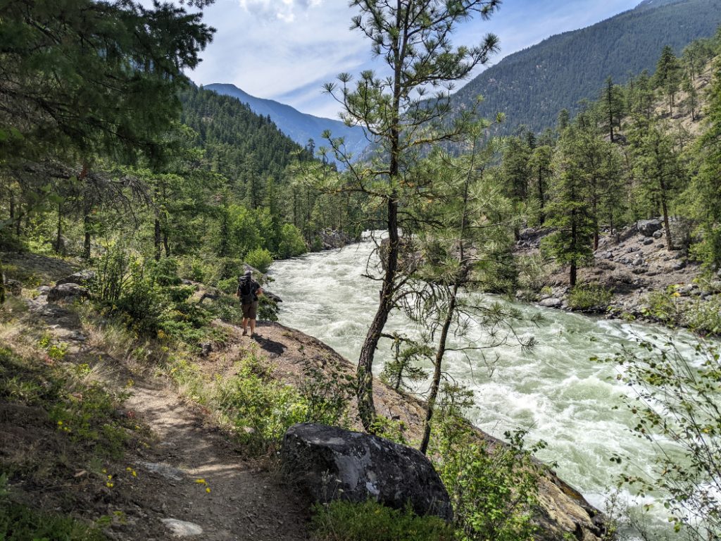
We may have started a few hours later than we expected, but this was our first backpacking trip of 2022, so we were happy to take it easy and enjoy the trail. After just a couple of minutes we reached a bridge over a gushing Stryen Creek.


Asking Rock
You’ll quickly reach a spiritual location for the Nlaka’pamux people; Asking Rock. The large moss-covered rock is adorned with pictographs as it was used the starting point for coming of age training ceremonies known as vision quests. Nowadays, local people stop here to ask spirits for safe passage through the Stein Valley.

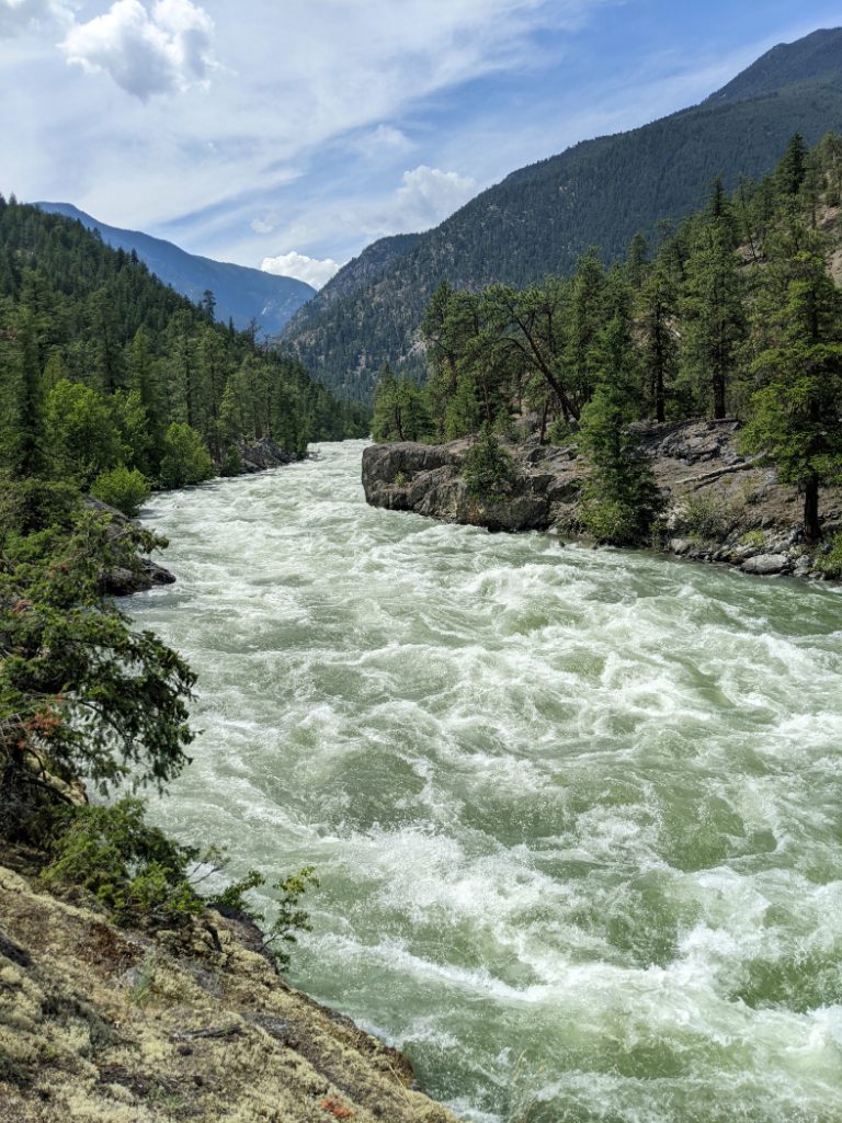
Asking Rock is a great place to stop and take a moment to feel the vibrations and massive power of the Stein River as it thunders past you. When we visited the waters were raging!


The word “Stein” comes from the Nlaka’pamux word “stagyn” which means hidden place. It feels pretty appropriate as entering this pristine region seems a million miles away from the rest of civilization.
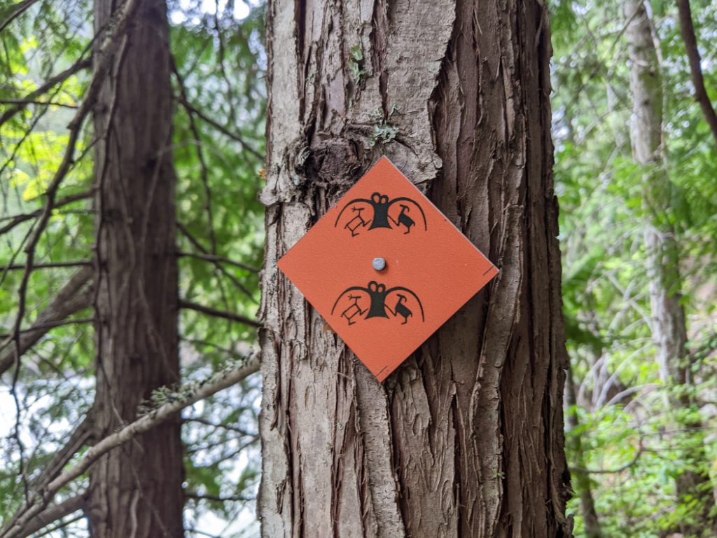
There are blazes on the trees, with one of the pictograph images as a logo. Follow these.


Lower Stein Valley Ecology
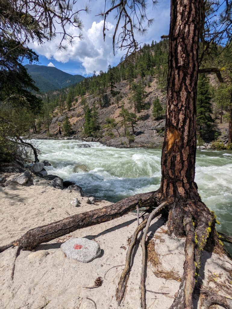
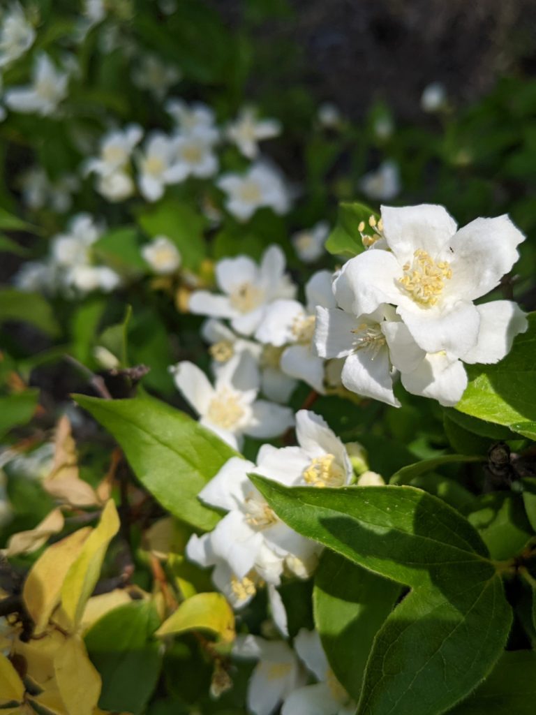
The trail to Loop Camp feels very different to other areas of British Columbia’s Coastal Mountains. The Lower Stein Valley is covered by dry ponderosa pine forests, that leave plenty of space for oodles of wildflowers. This is brilliant in the springtime when it is warm (and has an incredible sweet, pine smell…) but can be brutally hot in the summertime with temperatures climbing to 40°C+.

Loop Camp Facilities
Loop camp is a pleasant place to camp, a short way in from the river. This means it is not quite as loud as the next campground, Devil’s Staircase Camp, which close to the thundering river. Loop Camp facilities include bear cache lockers and a pit toilet. There are 6 spots for tents.


If you are staying in Loop Camp, make sure you remove all food, toiletries (and items that might smell like food, like pots that you cook with) and put them in the bear caches. No campfires are allowed. The risk of wildfires is pretty obvious when you see how dry the forests are, and if you consider the history of the previous few years!

That is the trail to Loop Camp in the Lower Stein Valley. We continued on a bit further on this occasion, but I took so many photos (and it was such a palaver to reach the start…) that the first campground is a better place to split my posts. I’m excited to share more of the trail in my next post to the Devil’s Staircase and beyond. Hopefully this beautiful Provincial Park will re-open again soon so more people can experience it.

27 thoughts on “Lower Stein Valley to Loop Camp”
That river is so gorgeous, Josy, I could sit by it for hours. What a lovely place for you and Marc to get away to!
Ah, that makes me want to revisit the Lower Stein again so much! I remember it smelled so good, even in September. The river was super loud for us at Devil’s Staircase camp so it must have been roaring at this time of year!
That’s a pity the ferry wasn’t running – it’s so much fun. The Drive BC website is the place to find out if it’s running – it includes all the inland ferries.
Lol I wish I had know that before we went! Although maybe not as we might not have attempted it. We should have parked on the Lytton side and walked over the bridge (the lack of phone signal meant I didn’t know that either!)
The smell is fabulous isn’t it?
Yes, I just love the ponderosa pines!
Wow, the place looks lovely and the story on the asking rock is interesting. I hope it gets opened again.
Me too! I assume it will take some time as the poor locals have so much to deal with after the fire. But I wanted to document it to help guide people there once it’s ready again. 🙂
The Lower Stein Valley looks so beautiful and serene. I would love to visit one day and enjoy the beautiful natural environment. Gorgeous!
Thanks Jennifer! <3
This looks like such a beautiful hike! Thanks for sharing
Thank YOU for reading Constance!
Wow such a beautiful hike! Adding this to my list, thank you for sharing. Definitely interested in the Asking Rock
Thanks Linda. It is a very cool spot with all the water rushing past. The whole area vibrates with the movement of the river.
You always have great posts about hiking trails! Thank you for sharing! I hope to make it to Canada one day!
Thaaaank you for the lovely comment. 🙂
What a beautiful trail, Josy! I really appreciate the information about the Native people and the significance of the land. Thank you for sharing that.
I was really grateful that they post so much information about the area at the trailhead. We got to take some time to learn before setting off.
It’s amazing that the First Nation people have partnered with a park system to create a Park that fits their needs and culture. Is this unusual in BC?
I think there are a few other parks that do something like this. təmtəmíxwtən/Belcarra Regional near Vancouver is a collaboration between the Tsleil-Waututh nation and Metro Vancouver (you can read a bit about them here: https://twnation.ca/new-name-announced-for-t%C9%99mt%C9%99mixwt%C9%99n-belcarra-regional-park/)
It seems to work well, so I hope there are more like this.
Thank you so much for this article on lower stein valley camp, I have been wanting to hike it, but thought it might be too difficult. This really helped!
It was actually really good for getting your legs used to backpacking in the spring. I think if you do the whole traverse it must be tougher…but the start of the Lower Stein is an absolute pleasure.
So nice this trail is open again! Looks like an amazing place to hike!
Wow this looks like an amazing hike and a beautiful river! Thanks so much for sharing, I would love to explore one day.
Canada has so many beautiful National Parks..this one looks esp stunning…great recommendations…
It’s mad, this isn’t even a national park – just a local provincial park. I often find these are just as good as the National Parks, but with fewer people…
This looks like a fun, easy, and beautiful hike. The Stein River! Wow! It looks so powerful.
Glad you were able to visit before the wildfire. Looks like you had fabulous weather to start your backpacking adventure.
The following day was very soggy, but yeah we had amaaazing weather on the first day. 😀