
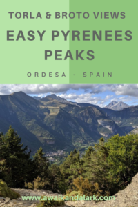
Miradores de Ordesa loop via Broto
 If you fancy an amazing day hike near Torla and Ordesa, have a peek at this loop. We did not know the area well. but we made up a walk that took us past fantastic viewpoints (Miradores de Ordesa), up some Pyrenees peaks and then back down cliffs, through forests and past picturesque villages.
We started by hiking from Torla to Mirador d’o Molar, which I described in my previous post. On our return journey this route allowed us to walk up several Pyrenees peaks; Punta Diazas (2169m), Pico de la Cuta (2242m) Pico de Enmedio (2137m) Tozal dera Cana (2006m) and then several small peaks on Pico Ferrer. It was a peak-baggers dream hike. At the end of the day we found ourselves in the pretty medieval village of Broto which was just a couple of kilometers walk back to Torla.
Miradores de Ordesa map
Miradores de Ordesa to Broto – the basics
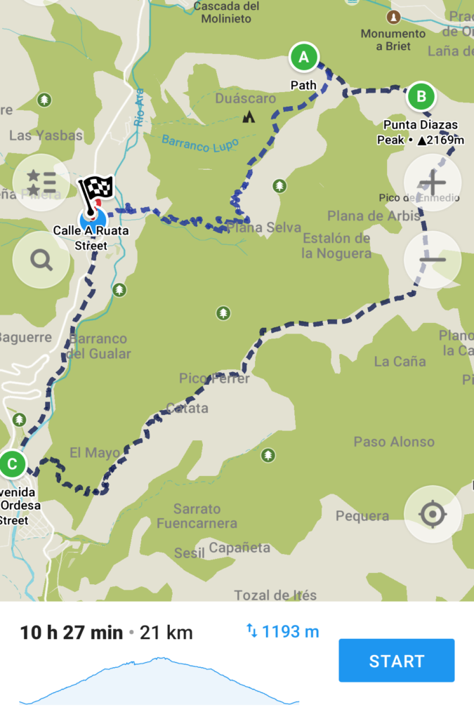 Distance: 21 km (full loop), 14.4 km (Mirador d’o Molar to Broto)
Elevation loss: -1314m (on the way down)
Cumulative Elevation Gain: 1475m (for the whole loop)
High Point: 2242m
Time: 6 hours (one way) 9.5 hours (whole loop)
What to bring:
Water, snacks and your camera!
The 10 essentials.
Dogs:
Okay but keep them on a leash.
How hard is it?
If you do the whole loop it is challenging. Doing the hike in one direction would be more moderate.
Maps:
We used a mixture of Maps Me and hard copies of maps that my mum brought. You can see a map of the area (and the path we took on this link.)
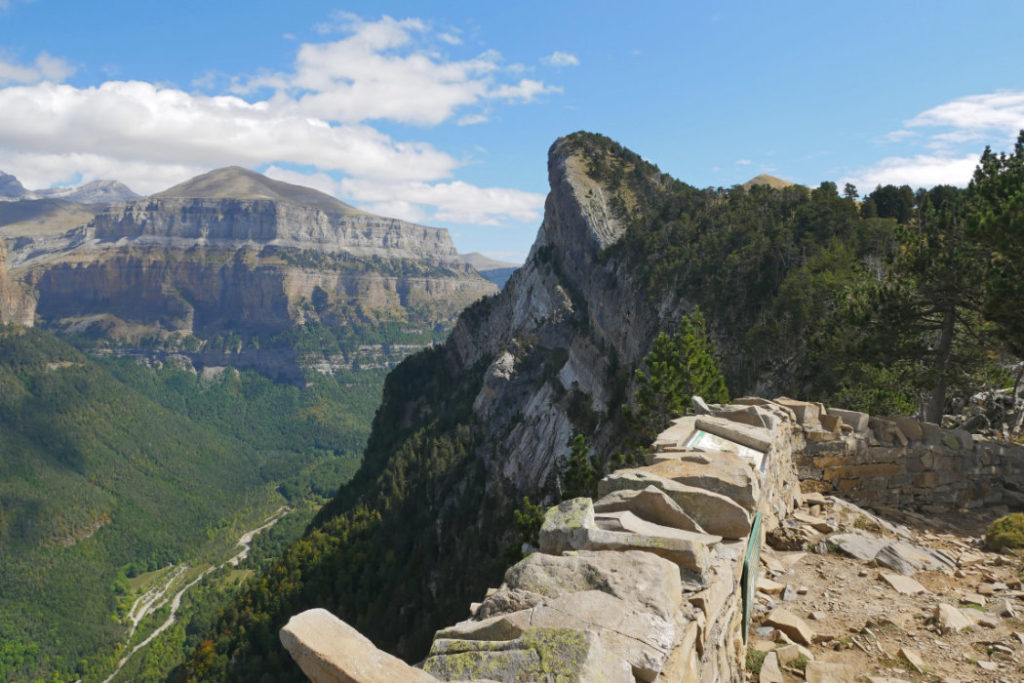
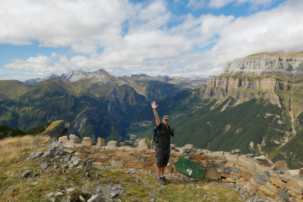
Mirador d’o Molar
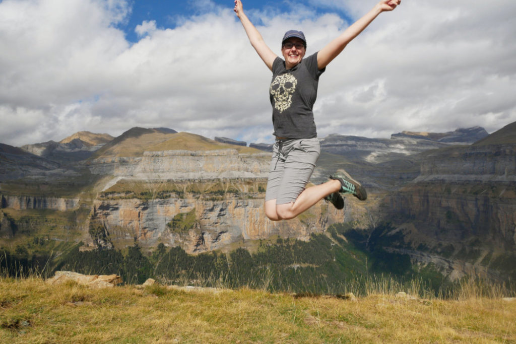
The second half of this loop starts at the ridiculously beautiful viewpoint, Mirador d’o Molar, that overlooks Ordesa y Monte Perdido National Park. If you didn’t already, take a peek at my previous post about the first part of this loop. The first 7km of this route involved 1100m elevation gain, so at this point we were a bit hot, tired and looking forward to an easy hike down. When we first saw this view (pre-lunch) I remember thinking that I was glad we didn’t need to climb up that knob of a peak.
Punta Diazas – Our first Pyrenees Peak
However, after munching some lunch and taking a zillion photos, I looked at that knob (Punta Diazas) differently. I started to wonder if there was a path up to it. We spotted a possible path on our map, so headed towards it.
At first the path was easy to follow and very clear, but half way up the steep peak it disappeared. Luckily there was another hiker at the top of the ridge, so we headed straight up to him.
Punta Diazas Viewpoint (2169m)
This peak would be pretty scary if it was windy! Someone has built a wall at the top, but beyond that is a vertical drop, right down to the Ordesa Valley below.
This is the view back to Mirador d’o Molar where we had just stopped for lunch. From here it is easy to see why Marc was worried about me standing near the edge. That drop-off is huge!
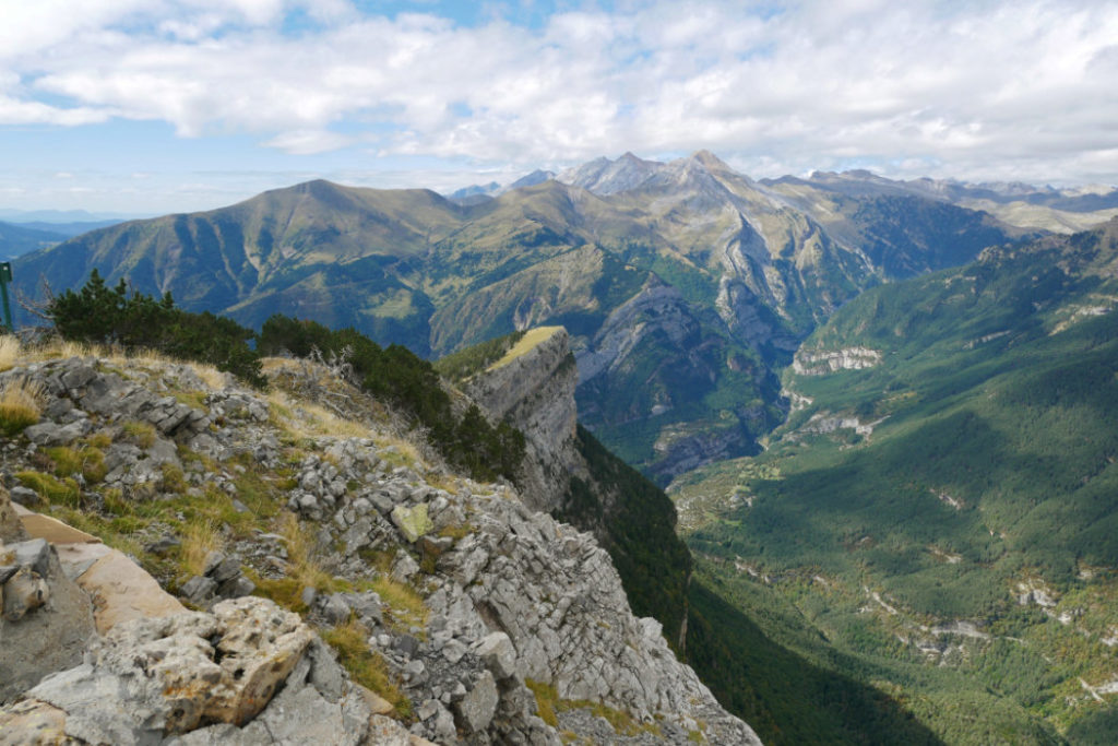
So, once you’re up high, the views are amazing (and the drop-offs scary) in every direction!
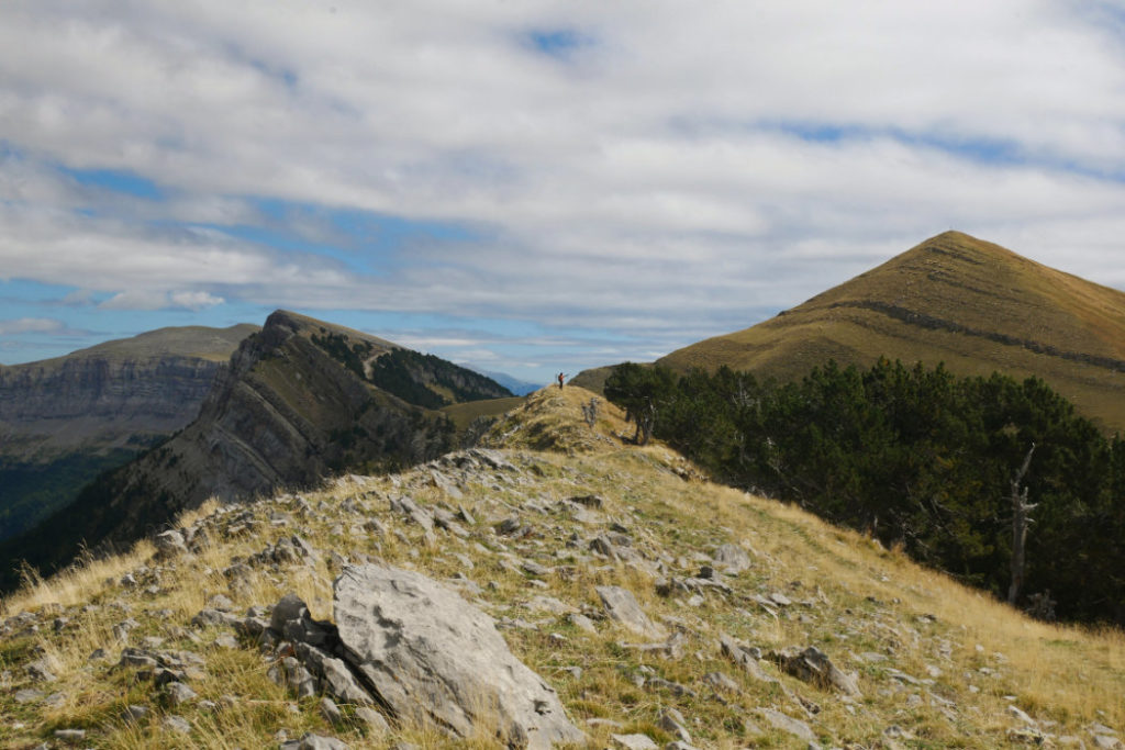
There is a good path along the ridge at the top of the Ordesa Canyon. Can you see the other hiker further along the ridge for scale? This scenery is simply vast.
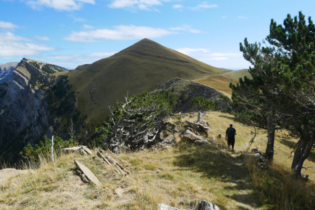
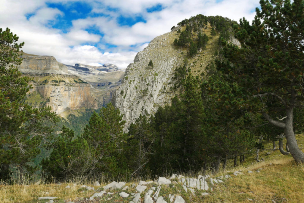
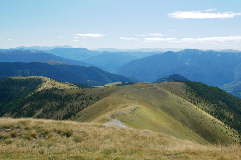
We headed towards the next peak, Pico de la Cuta which was covered with grasses and goats.
It’s is only 82m extra elevation gain to walk up this grassy peak. The views are fantastic the entire time.
The goats on Pico de la Cuta’s slopes all had bells, so the whole area rings with the echo of musical goats. We took a long path around them so as not to disturb them.
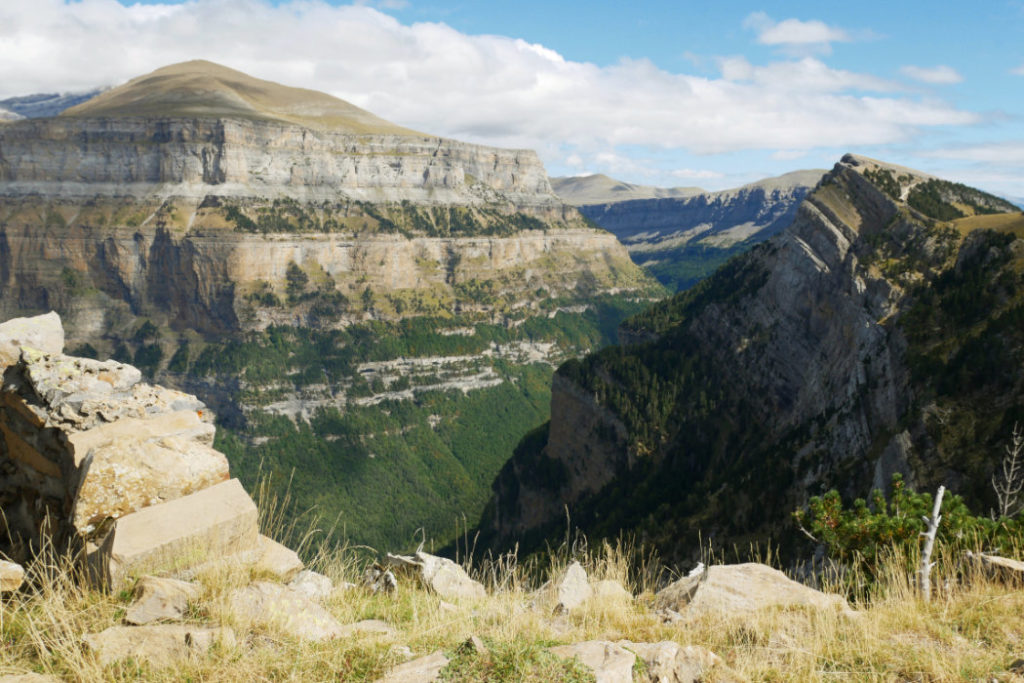
Pico de la Cuta (2242m)
From the top, you can see the road along the top of Ordesa Valley. We could also see the three Sisters – Cilindro (3325m), Monte Perdido (3355m) and Añisclo (3254m) – the largest limestone massif in Europe.
Pico de la Cuta was the highest point of our day. From here we needed to descend 1340m to return to the villages of Broto and Torla. It looks like a teeny bump from above, but we also stopped at Pico de Enmedio (2137m) along the way.
If you can’t hike, cycle or cheat
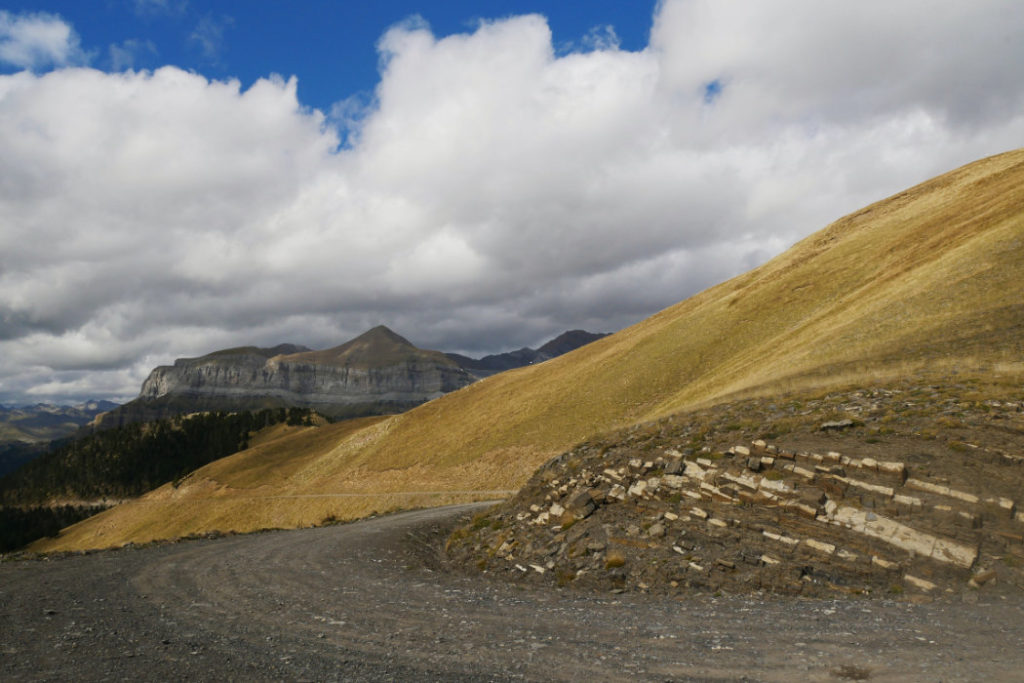
As I mentioned in my previous post about this area, if you do not fancy hiking so far, there are other ways to see these views. You can’t drive up with a private car BUT you can take a 4×4 from Torla all the way up into the mountains (link to one of the companies that offer this). If you like cycling, I found a cycle route that will take you past all these viewpoints along the road.
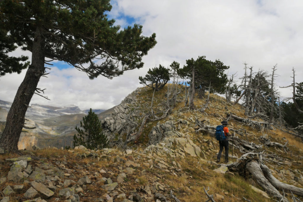
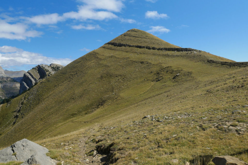
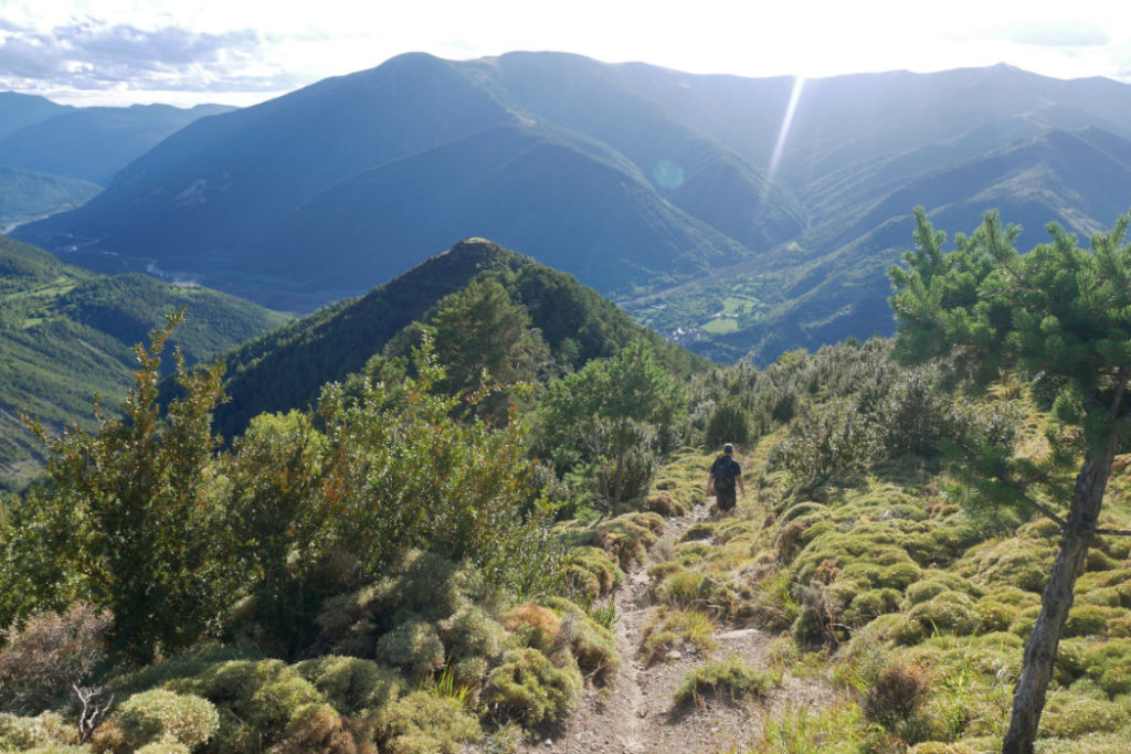
Tozal dera Cana (2006m)
We didn’t reach the top of the next peak. Instead we started to descend, following the road. It was a pretty good path, and not too steep at all, so we could jog down it. I find it much easier on my knees when we run down, rather than walking.
Views down to Torla
This is the view down to Torla from Pico Ferrer. It was slightly upsetting to realize we still needed to get all the way down there. My knees were already anticipating turning into jelly.
Maps.Me problems – Pico Ferrer
We had made up our own route using a mixture of the app, Maps.Me and hard copy paper maps. However, we failed to notice that the path down Pico Ferrer was not on the hard copy map. Oops. It was fine most of the way down, but at one point, we lost the path and had to fight our way through spiky plants, then climb down a cliff.
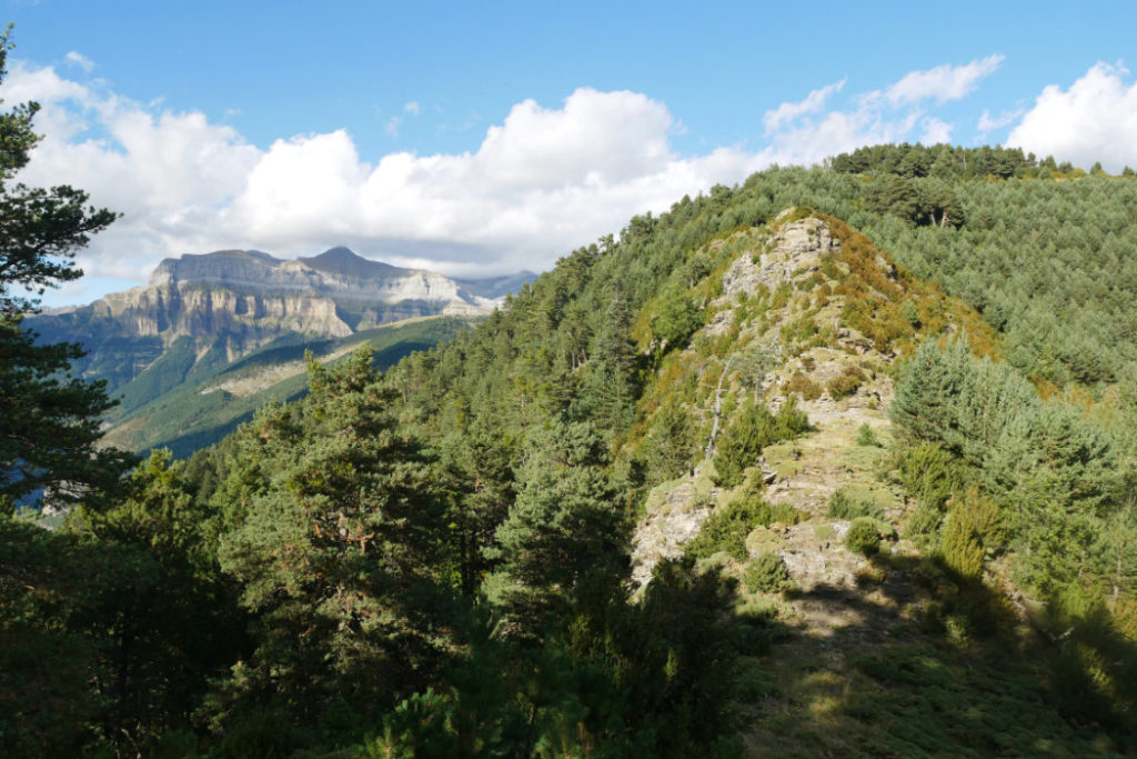
Everything was better when we re-found the path. The path undulates, so every so often we had to climb up mini peaks on our way down the mountain. It was pretty exhausting, but at least the views were spectacular.
There were quite a few ruined houses up on the mountain.
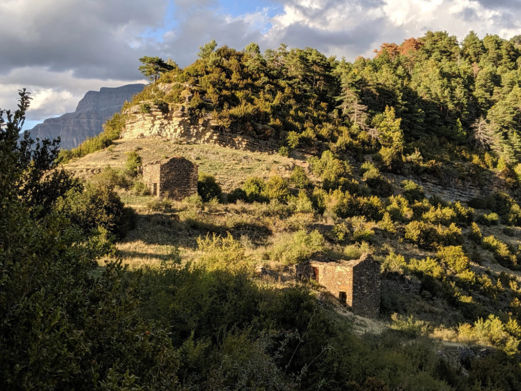
Ermita de la Virgen de Murillo
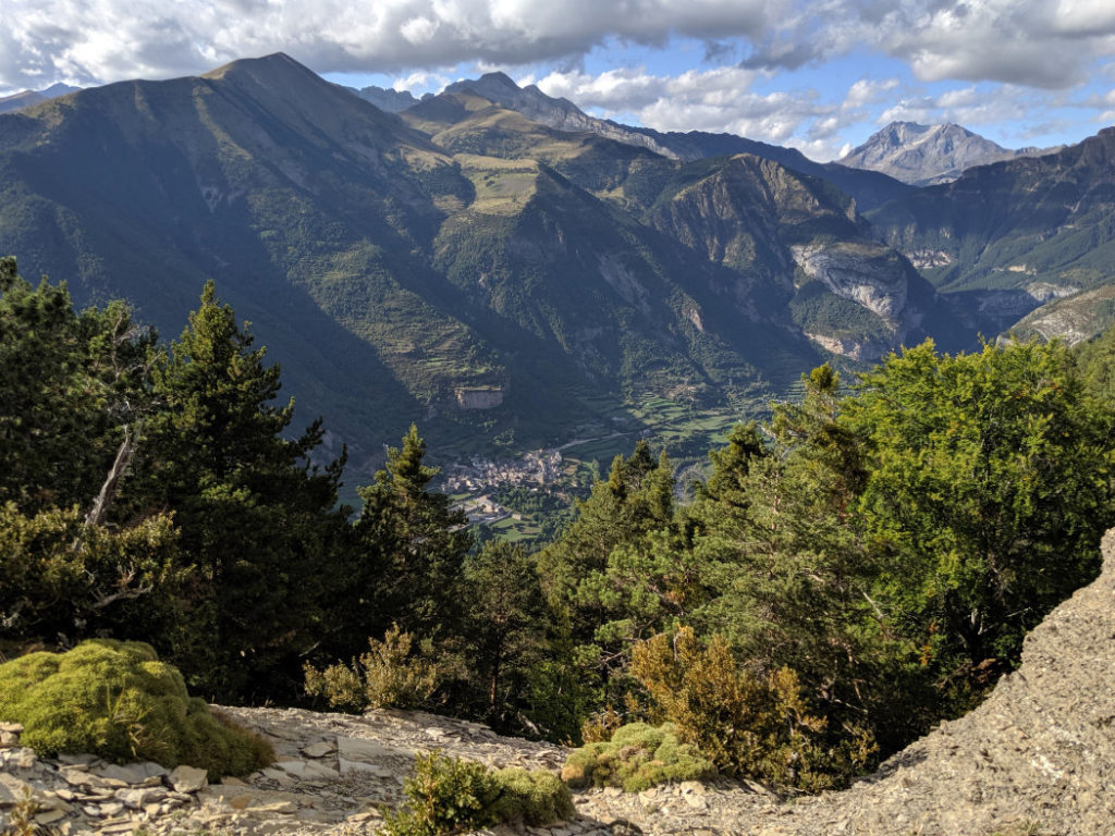
Right above the village of Broto, was a small church, Ermita de la Virgen de Murillo. This was one of the few places where we saw other tourists! There was one other couple who had climbed up to see this church (and the pretty view.)
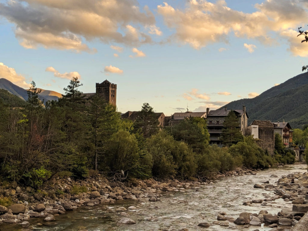
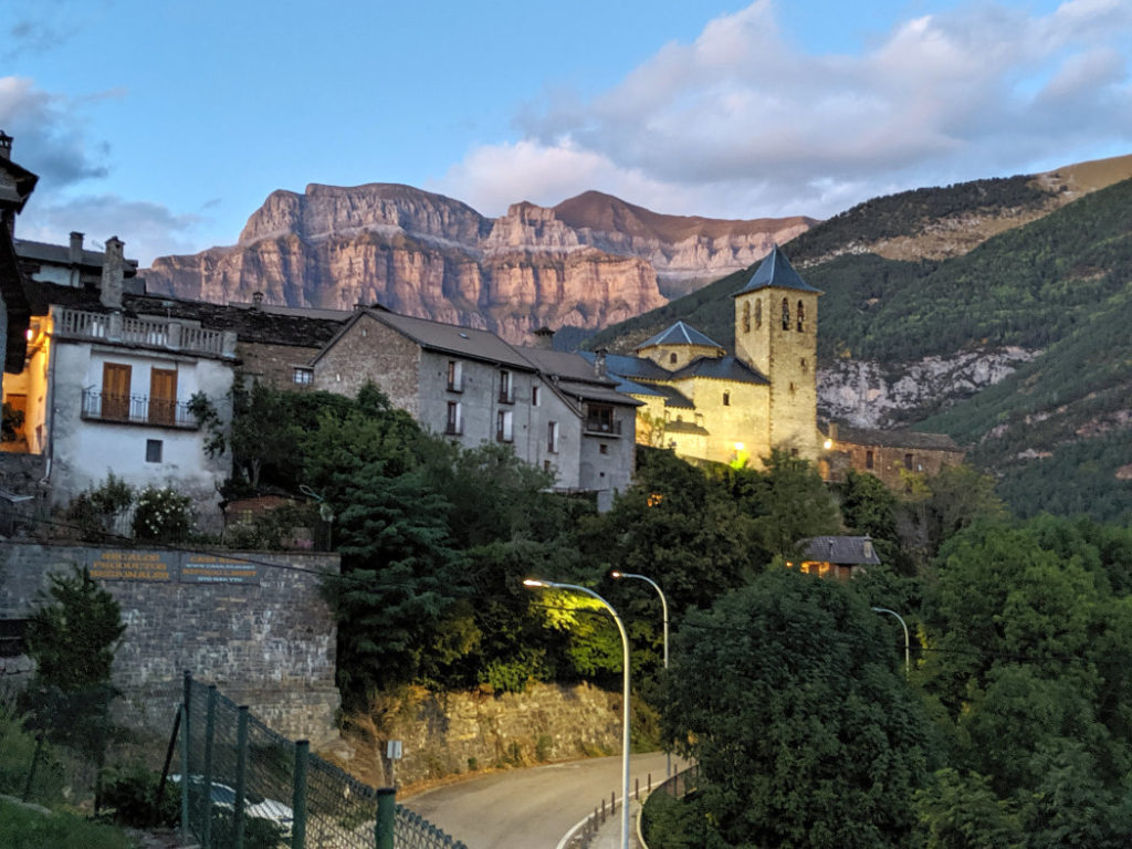
Broto village
The path led us down from the mountains into the lovely medieval village of Broto. We noticed a waterfall cascading down the cliffs that loom above the village, so we made a note to come back and see it the following day.

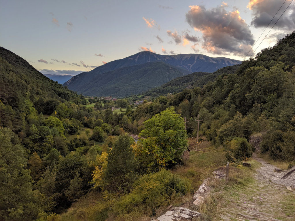
Broto to Torla
There is an easy path between Broto and Torla, along the Río Ara River that covers the 3.2 km between the villages.
There is a bit of a hill on the path to Torla, so you gain 140m elevation on this last little section. It actually felt really good to walk up a hill again after the previous long descent.
The entire loop back to Torla took us over 10 hours, so even though the views back to Broto were pretty, we were mostly concentrating on what we should eat back in Torla. It was just starting to get dark when we arrived back in the village, so we were ready for food.
I hope you can see why we thought this was such an amazing adventure. It was slightly stressful on the occasions when we lost the path, but on the whole, the spectacular views made this long walk totally worth the effort. It is the most elevation gain we have ever attempted on a single day, so it also gave us more confidence to keep exploring the Spanish Pyrenees. I really hope this will encourage you to explore Torla and the surrounding area too.
49 thoughts on “Miradores de Ordesa loop via Broto”
Wow this looks like such a beautiful hike!! The views are gorgeous and it looks like you had great weather for hiking. You got to see so many different Pyrenees peaks! The village of Torla also looks adorable. Your posts are the first I’ve heard of the Ordesa Valley and every single hike looks gorgeous, I will have to add this area to my Spain wish list!
Thanks Brianna!
We were super lucky with the weather, we were expecting thunderstorms and rain the entire time (from the forecast)! BUT if you do want to visit, September does sounds like normally it has gorgeous weather like this – perfect for walking!
Wow – what a cute little village! I want to go exploring. I’d have to take a car though. I’m lazy.
And again, fabulous photos!!
Patricia Rickrode
w/a Jansen Schmidt
All those villages were really lovely to explore! And don’t worry! I still think it would be a fantastic area to explore by car.
My family lived in Spain for 3 years but there were so many spots we didn’t get to see, including this one! I also wasn’t that much of a hiker at the time, but I am now and would so enjoy doing this one!
Oooh I didn’t realize that Andi! Do you have posts about Spain on your blog? I will have to take a peek as I always love your photos.
Wow, I’m not familiar with this area at all and I can’t believe it – the village of Broto looks gorgeous and I love the shape of these mountains! Each one is different, like Pico de la Cuta looks smooth and gradual, then you’ve got that one in the back that looks like something out of Sedona or the Grand Canyon, and then the sharp jagged ones like the Alps. Guess I need to check out the Pyrenees. I also never saw goats like that in any of the European countries I visited, the horns are crazy looking.
So true about jogging being better on the knees on a downhill, seems counterintuitive but it feels so much better. Maybe it’s the momentum, you’re not putting as much of your weight into each step? Who knows. I’d love to see the science behind that though. Nothing worse than jelly knees.
Cool that you guys routed your own path. I’ve never tried MapsMe, sometimes I imagine I can route my own just from looking at Topos but I haven’t had the courage yet. How long were you guys over there hiking in Spain? I must have missed it in real time, wish I’d followed! The only hiking I know about in Spain is the Camino de Santiago.
Isn’t this area awesome!? There were quite a few multi day hikes, so I am sure it would be your cup of tea (the snacks are pretty good too…)
Our original plan was to hike the Camino de Santiago BUT once I started looking into it, it all seemed a bit too busy for us (it is super popular at the moment.) We fancied finding some quieter trails, although we did cross the Camino de Santiago quite a few times!
I think I mentioned to you we’d be in Spain (on twitter) as we were in Europe at the same time as you. I have LOVED following your walks over the last month, so I will try to be better at posting on twitter when we travel next time. You really inspired me.
Aw dang, well I’m glad I didn’t go to Spain this time then because I would have been really mad at myself for blanking on the tweet and missing an opportunity to meet up!
Do you think you’ll do the Camino another time? That’s kind of why I haven’t looked into it yet either, it sounds so overrun these days, and each route goes through so many towns. It seems like you can’t really camp either (although apparently the bunkhouses are super cheap). But it still seems like something we ought to do some day just for the experience. I imagine I will eventually.
I honestly can’t decide. We have done parts of it in both France and Spain and it is a fun walk (especially further from Santiago where there are fewer people…)
The thing is, there are sooo many good long distance walks that are similar, but less famous, that I am inclined to try those first. I always find it strange when one route becomes insanely popular, when it doesn’t seem that much better than other walks…
Holy cow this looks like an incredible place to visit. All the hiking is pulling me to plan a trip. Love it.
Yay! Thanks Nikki! That is how I feel whenever I see blogs about walks, so I am really glad if this makes you feel that pull too. 😀
wow! this looks like such an amazing hike and the images along the way are incredible.
Thanks Karthika! Those views made taking photos easy as pie.
Josy, your blog posts have become very professional and yet still a personal dialogue on how your hike was enjoyed and certainly had me wanting to head over that way again!!
I will just have to stick with the local tramps around the Kaimais and further afield. Definitely refer to your NZ ones when I get a chance to do them.
Thanks Susanne!
I have loved seeing your wanders around Aus recently so I will watch out for when you get back to NZ. I am sorry I don’t always see your posts. I’ll keep dropping by when I see them in the WP reader.
Not a problem Josy. There are so many of us bloggers to keep up with. Got back from Aussie last month. Busy with volunteering and other things now that we are living back in the bay.
What a beautiful part of the world! The village of Broto looks really nice too – were you guys able to explore the town much?
Yes, It’s funny you should say that! We loved the look of Broto, so came back to explore (and see that waterfall) the following day. If you’d like to take a peek, I just published a post about it this morning: https://www.awalkandalark.com/pyrenees-villages-ainsa-broto-and-torla/
Haha – musical goats! Looks like a great circuit hike, and nice to finish off with a walk along the river like that (albeit with a little extra hill…).
Ah, the infamous maps.me – of course it’s not just them, it’s the user-supplied trail info that makes its way onto Open Streetmap that so many mapping apps use. I have the same issue with mine and we’ve been led astray before (even in Stanley Park!). On the other hand, it got us out of a spot in the Southern Chilcotins where our paper map failed us…
I really love it (as it shows so many more trails than some other maps) BUT we are learning to be careful with it (especially after hearing stories of people getting in trouble on climbing routes that they thought were walking paths!!)
Yes! Funnily enough when we were in the Rockies it was noticing that a trail on my app wasn’t the trail we were actually hiking on that inspired us to try it out and we found somewhere new and even more spectacular – but there were other “trails” that were clearly climbing or scrambling routes, and of course they all looked the same in the app.
The viewpoints are sooo stunning!! Love the little stone wall at the first viewpoint. I also had no idea there were canyons in Spain haha! Looks like you had such a great time and we need to go hiking together soon!
Same! I had no idea Spain was so full of dramatic glacier-carved scenery! These canyons were the most impressive, but we saw quite a few others in the Pyrenees.
Wow this sounds like a monster of a hike! 10 hours! Very well done, and the views were definitely worth it. But I gotta know, what did you get for food after your hike?? That’s seriously what gets me through the tough ones lol
OMG Julie, the food was amaaaazing! We had a truffle risotto, venison stew along with a apple strudel. The villages in Spain have such good grub after a long walk!
That looks like such a great hike! These views are amazing, I love your photos 🙂 Definitely need to check this out the next time I’m in Spain.
Thanks Katja! It’s such a cool (and uncrowded) part of Spain. I hope you like it as much as we did.
Your photos are truly incredible! What an adventure! I would say there is nothing better than being out in nature!
The views really are incredible. That drop off looks a bit scary. I’m not sure if I’d hike the whole way, but cycling sounds good too. That little village looks so adorable
Yeah, I’m not sure if I could now either – This was at the end of a long hiking season so we were pretty strong! Cycling the route would be amazing too, but it’s a huge amount of elevation gain. It’d be a blast on the way down!
Wow these views look incredible and sounds like a good challenging hike! I love using AllTrails on my hikes as well!
AllTrails is great isn’t it! I wasn’t using it at the time, but I wish we had, as it is better than maps.me as it includes all the contour lines.
The pictures are amazing! adding to my list 🙂
Yay! Thank you!
The views on this hike are spectacular!! Totally worth that long hike 😉 Need to add this to my Spain bucket list.
Thanks Shannon! Spain is such a gorgeous country to hike in!
This looks like an amazing experience! There are so many stunning views and I would love listening to the goat bells. The two little villages look like they would be so interesting to visit, I love the architecture!
I am so glad we stayed in the villages (rather than camping!) It was a great excuse to try their fabulous food, and I totally agree, the architecture is really interesting.
This looks like a really gorgeous hike! The views are stunning! I’m a sucker for beautiful views so would probably love doing this hike.
Thanks Helena!
It is impossible not to fall in love with the Pyrinnees in Aragon. I have been to the “lost valley” in Ordesa with the Cola de Caballo and it is just one of my most precious memories. I am soon moving back to Barcelona permanently and I know I will be spending the weekends walking along these peaks. I did not do this loop so believe me, I will be going there next! Thanks for sharing and inspiring =)
Oooh you lucky thing! Once you have moved, your weekends can be filled with the most epic explorations! I loved finding all the waterfalls on the way to Cola de Caballo…I would love to go back and stay at Refugio Goriz next time.
Have you visited the Aigüestortes i Estany de Sant Maurici National Park too? That area also blew me away!
Scratch that question. I just found your post about it. 🥰
So many peaks and so many amazing views! If it was me looking up at Punta Diazas and not being able to see a clear path I would have turned right back around. Because I’m not keen on falling off a cliff, I’m scared of heights and I am HIGHLY prone to getting lost.
So for all of those reasons you are an inspiration to me 🙂
Lol thank you! I guess we do tend to have (slightly too much!?) faith in maps. This would be a terrible route if you are not keen on heights though. The drop-offs were just enormous.
It’s great that you didn’t let things like getting a bit lost get you down and pushed on to have a fantastic time! I love that you used so many ways to create your own route – very adventurous!
I love hikes that take you along a ridgeline for so much of the time — you always get the best views that way. This one looks epic :).
Saaaame! Hiking along ridges always makes me happy (as long as it’s not crazily windy!)