Vancouver Walks – Goat Mountain
 Oooh I am so excited to write about this one! Marc and I attempted to climb Goat Mountain near the end of July. There was still so much snow that I almost fell off a cliff after slipping down a steep mountainside! (You can read about it on my post about Dam Mountain here. ) The thing is, it was SUCH a pretty walk that we were both keen to go back and try Goat Mountain again once the snow had melted. Two weekends ago we finally got around to it..I’ve just been slightly too busy to write anything since then! This is easily my favourite walk in Vancouver so far! Even if you can’t be bothered to read about the hike, scroll down to when we reach the top because the views were simply stunning!
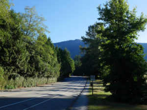
We woke up at ridiculous o’clock to try to catch one of the first busses up to Grouse Mountain. But I had a slight bus miscalculation. We took the #246 bus over to the North Shore, but I thought we needed to change busses earlier than we did. This meant we missed our bus connection, and had a 45 minute wait for the next bus. Oops. Rather than waiting, we decided to walk the last 5km to the trailhead. It was a bit of a hard slog on the edge of a steep road so Marc was pretty pissed off with me. BUT it meant we were all warmed up before we started the walk.
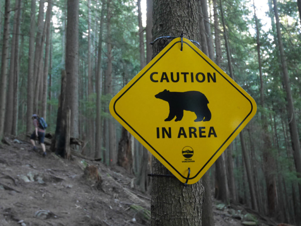
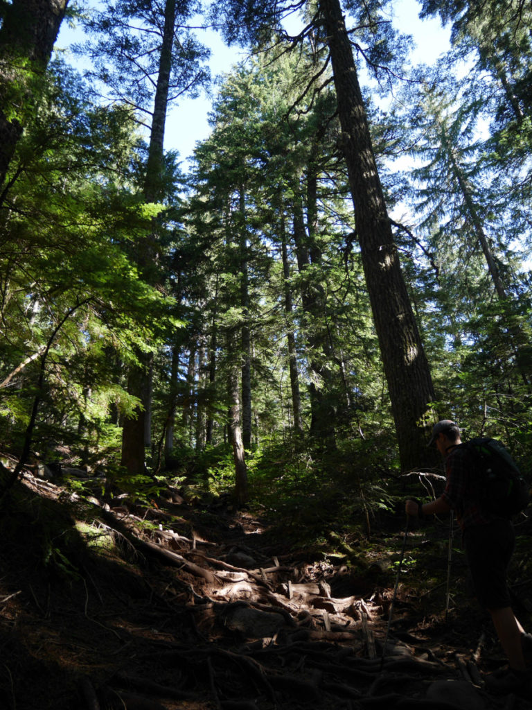
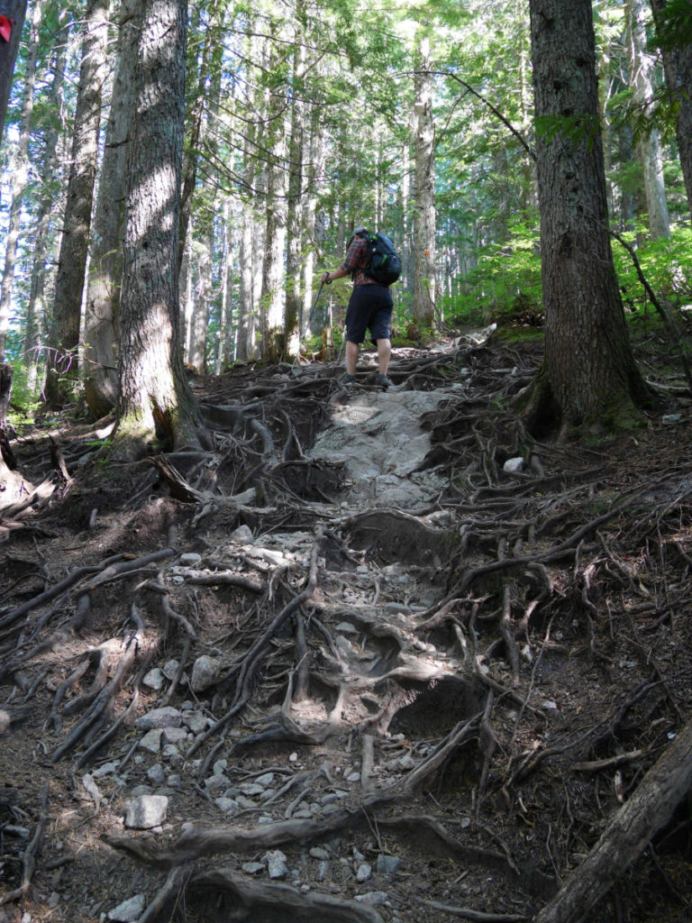
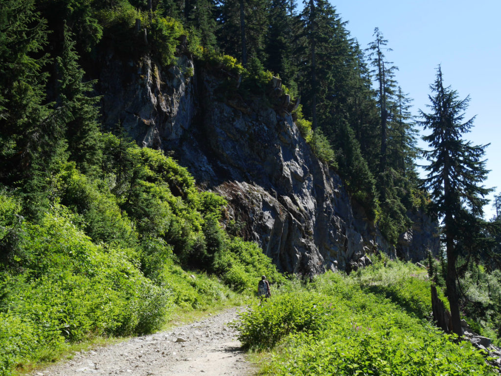
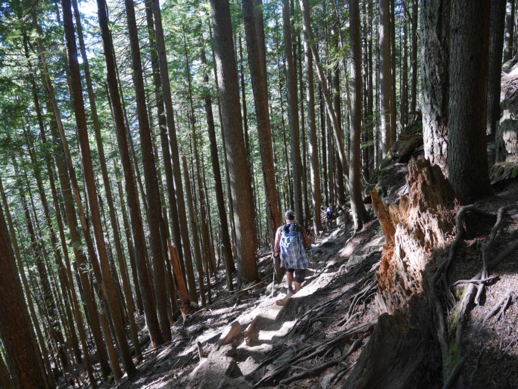
Last time, we hiked up the Grouse Grind, but this time we decided to try an alternative route called the BCMC trail. This trail runs parallel to the grind, but is slightly longer. This means it is less full of people, and although the steps are less well-kept, I thought it was a prettier route to hike. There were still plenty of people to chat to on the way, but this was just a fraction of the people we’d’ve seen on the Grind on a sunny Saturday morning!! Right near the start of the walk, we saw a sign showing there was a bear nearby. We figured that there were so many people around that we were unlikely to see it.


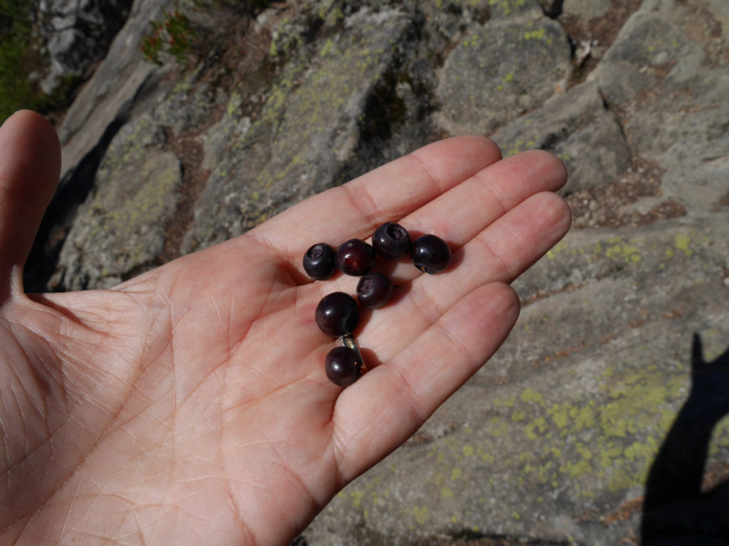
The BCMC trail was steep, and not that much easier than the grind. There were plenty of interesting roots to clamber over. Once we were high enough the sun streamed through the trees, covering the forest floor in pretty, dappled light. There are a few happy log-faces along the walk. I also found a berry that i’d never seen before. Please let me know in the comments if you think it’s edible so I can try it next time I see it! I don’t like to try berries unless I know they are safe!

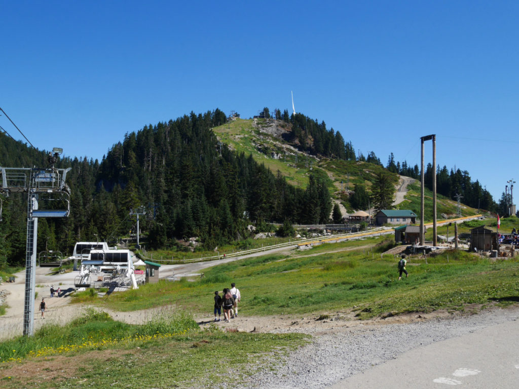
The BCMC trail took us a little longer than the Grind, so we were at the top after 1 hour and 45 minutes. Once we made it to the top, we were greeted by lots of legs in the air, as someone was giving free weekend yoga classes at the top of the mountain! I wonder how many of these people walked up for their yoga!? Anyway, this time, there was no snow at the top of Grouse. Phew!

The last few times I’d made it to Grouse, we had not been able to see the bears. So, instead of having a break looking at the views, we headed over to the bear enclosure to meet Grinder and Coola. Both of these grizzly bears were orphaned as cubs, so they now live on Grouse in a mini bear sanctuary that is just for them. Grinder is the smaller dude who is in charge and Coola is the bigger bear who just likes to chillax. You can find out more about them here. This time we arrived before the lumberjack show, so we got to see them!


How cool is that!? I loved meeting them with a fence between us. But I have to admit I would be far less keen to meet them out in the mountains!
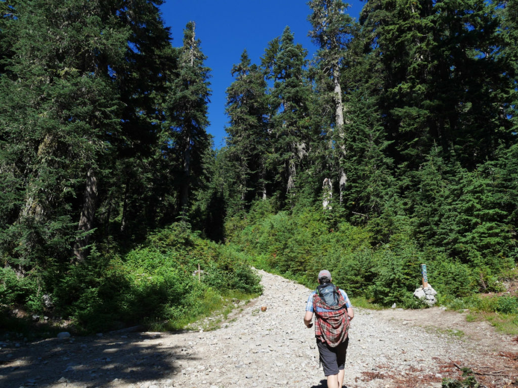
The walk up Dam mountain was soooo much easier than last time we attempted it in the snow! It felt like no time at all to reach the meadows below the summit. Now the snow has melted, any place that was not covered by trees, was decorated with lovely wild flowers. I don’t know how we missed all the sign posts last time we attempted this walk. Maybe they are brand new as I didn’t remember them at all!
You might have noticed that Marc’s top changed colour. It was a hot day, so he brought a change of shirts. Each time he felt too sweaty he’d swap shirts, and let the other one dry by hanging it on his backpack. It’s a clever way to keep comfy on a long, hot walk.
The top of Dam Mountain was even more fun than last time! On the approach to the rocky peak, there was lots of blueberry bushes. I had a good snack of berries.

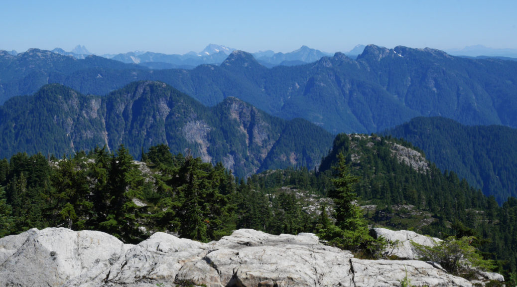
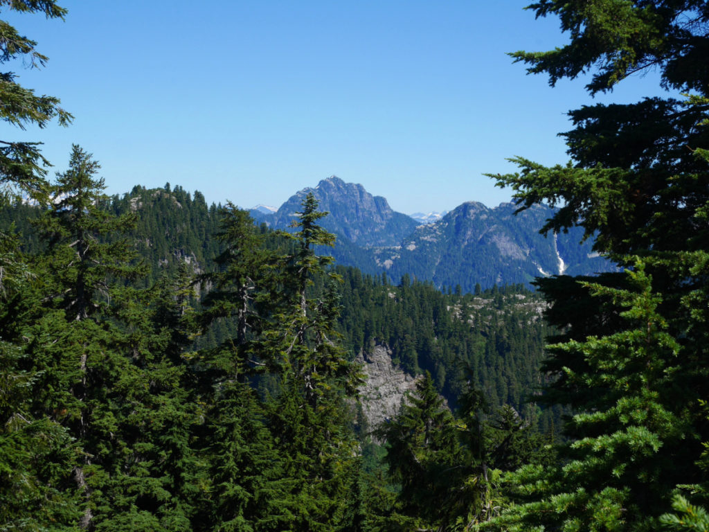
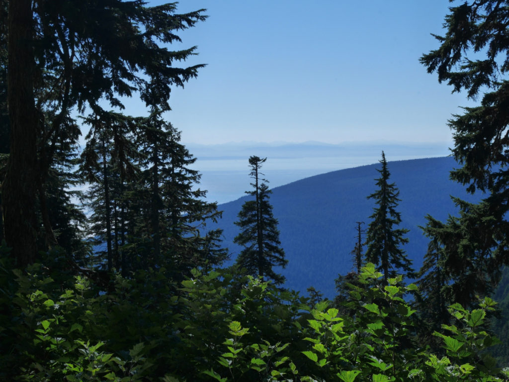
We had a good view over to the Cypress Mountain area where I climbed Black Mountain the week before. It was a super clear day so we had a good view over to Vancouver island as well. In the other direction we could see Goat Mountain, where we were planning to go next. You can see we’d have to drop down before climbing back up to the peak.

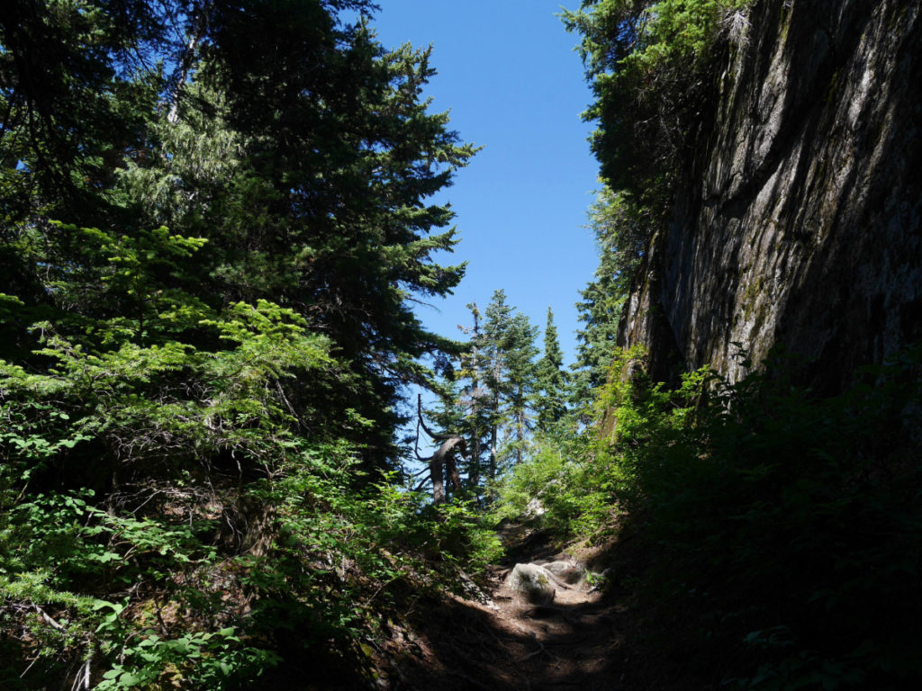
The next mountain was Little Goat Mountain. The slopes of this mountain was where I nearly fell off a cliff last time. It was still a steep walk, but I felt a lot safer without having to worry about sliding down the mountainside! The top of this mountain is covered in trees, so you don’t get a 360 degree view. I still loved seeing glimpses of the surrounding mountains through gaps in the trees.

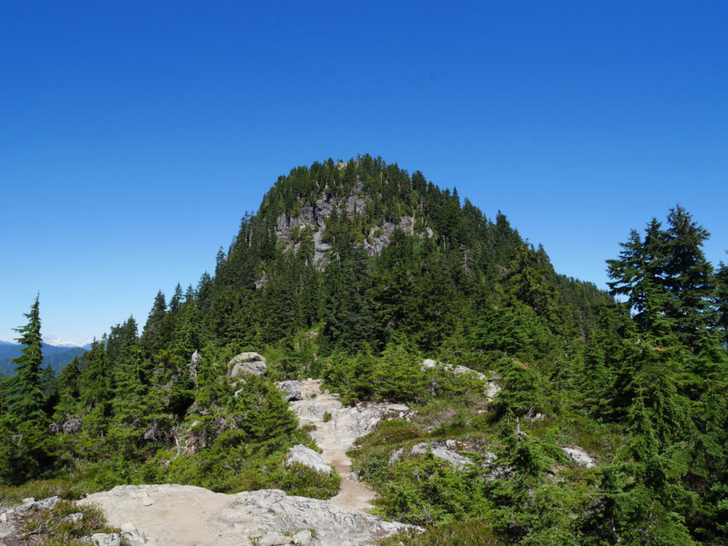
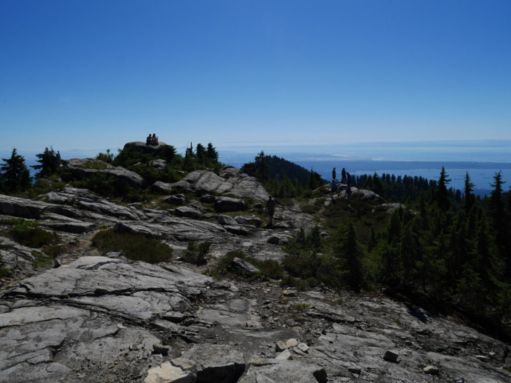
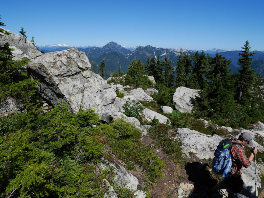
Finally we made it to the ridge that leads to Goat Mountain. We could see the last climb looming above us – it looks pretty tough, even though we were already most of the way up!
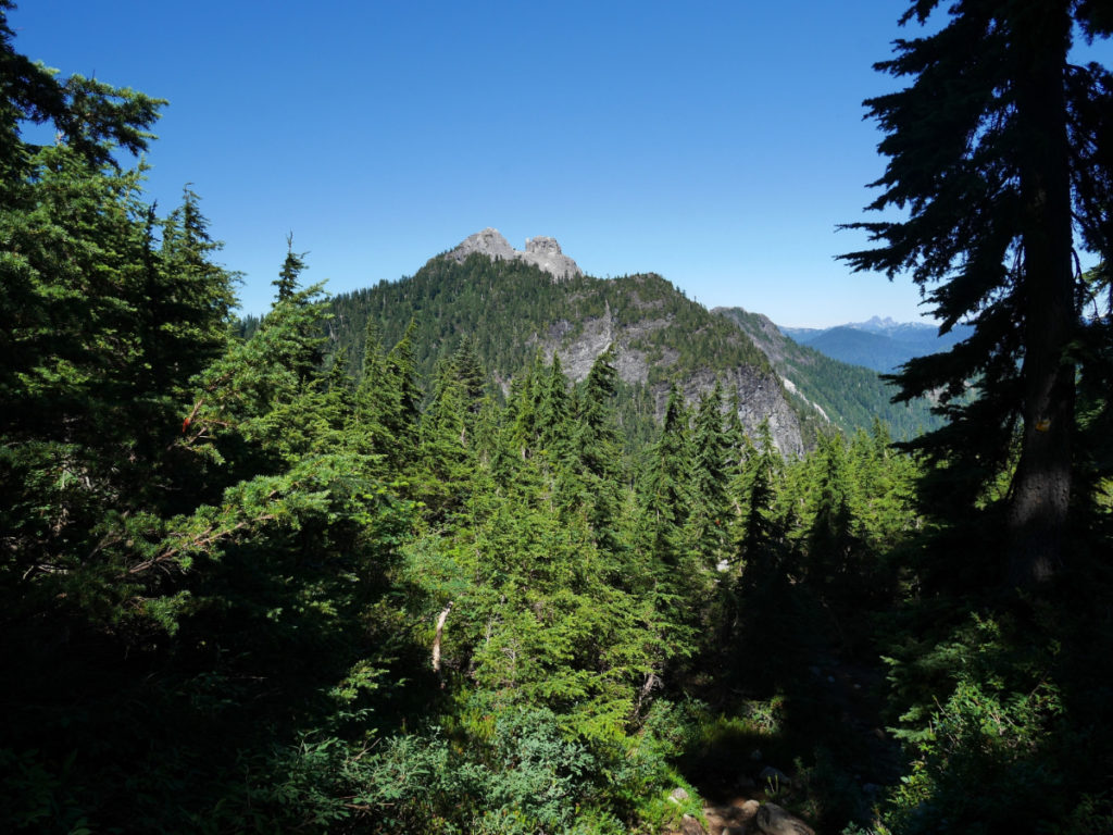
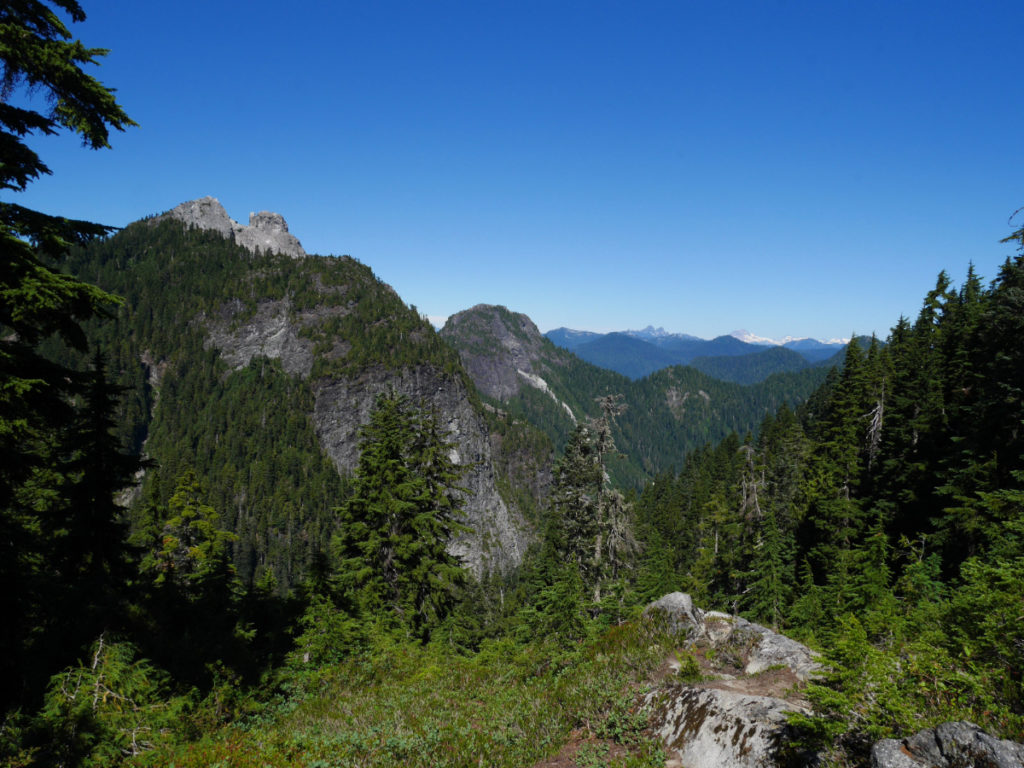
From this ridge you can look over to the gorgeous Crown Mountain. It is hard to see from these photos, but there is a STEEP climb down, and then back up again to reach the Crown. I’d love to do this one day when our legs are a little stronger. We met a lady who had just finished that walk and she was really dusty, and covered in scratches from the scramble! At least we know it’ll be tough and something to aim for!!
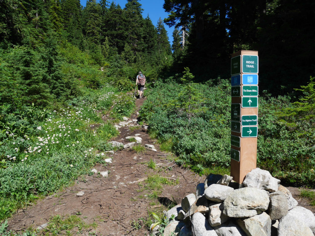
If you ever decide to climb this mountain, bring a map! The route is well marked with sign posts BUT without a map we would probably have followed other climbers straight up the face of the mountain. However if you keep to the right, there is a second path that goes around the back of the mountain. It is still steep, but it is much easier than the first path to the left! There was a warning sign to say that Goat ridge is a challenging walk. But to be honest, if you take the path we followed, it was totally doable! There are a couple of very steep sections, but some lovely person has left chains to help pull you up.


The very last section of the climb was up a rock face that is covered in tiny heather flowers. It smelt lovely, and we started to see the AMAZING views.


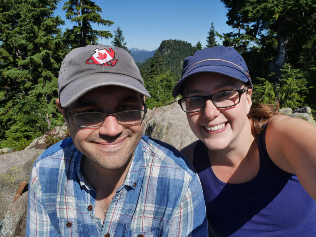
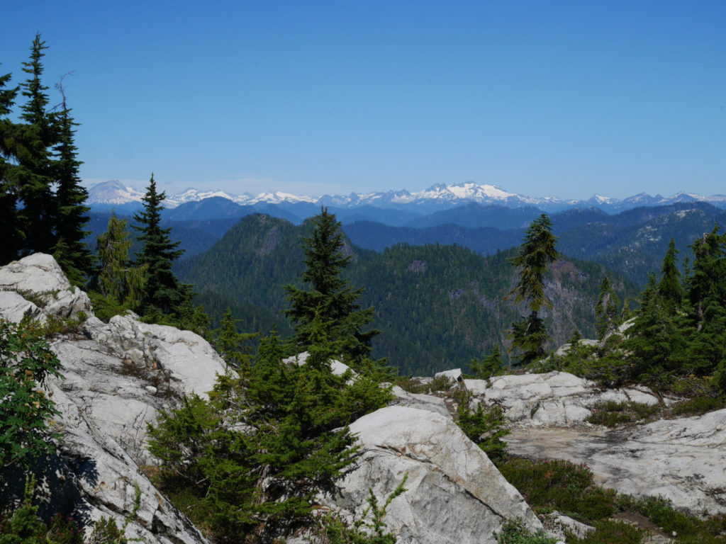
It is hard to describe just how happy I am to be at the top of a mountain looking down at a view like this! My heart was soaring, and I could not stop smiling and running around the top of Goat Mountain taking photos in every direction. I mean just look at this vista!
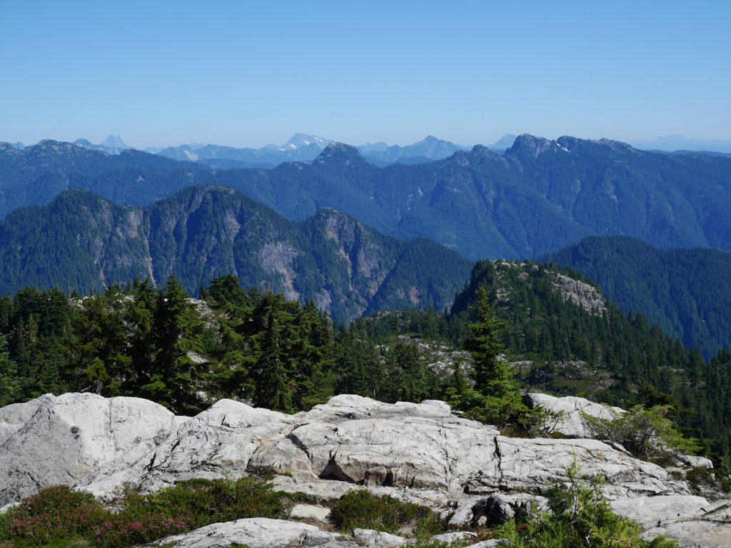
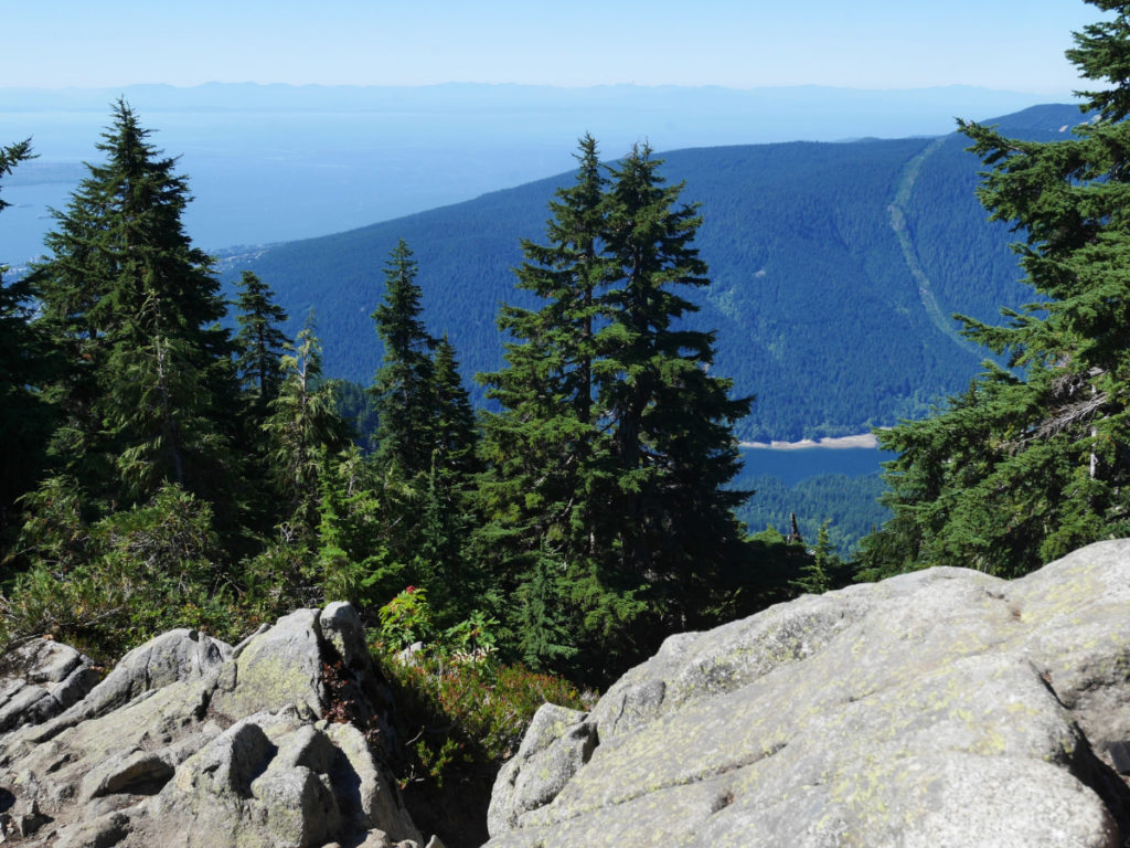
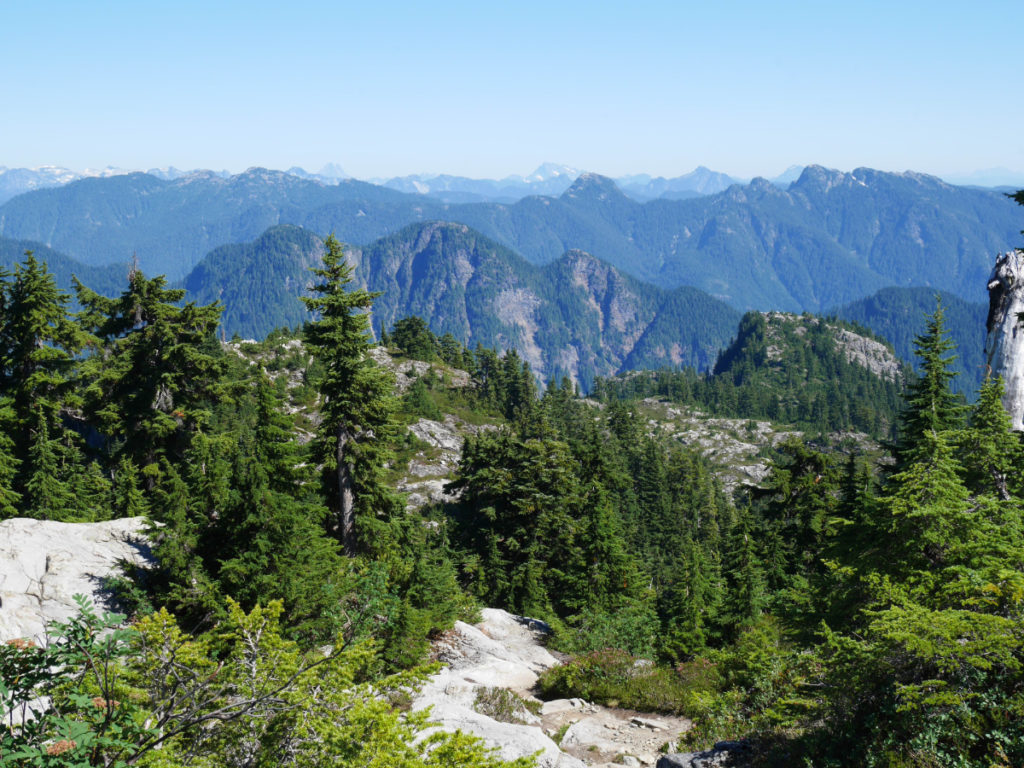
I took a few panoramas to show the GORGEOUS views from Goat Mountain. Please click on any of these photos to see a larger version of them. The first photo is facing East-ish. You can see America’s Mount Baker on the right – that is South East from Vancouver. You can also see the white peaks of Garibaldi Provincial Park and Whistler which are North of us. The second photo is facing North, with a new view of Crown Mountain on the left. The third panorama is facing South and West. You can see past Crown Mountain out to Vancouver Island and the peninsula on the edge of Vancouver where I work.


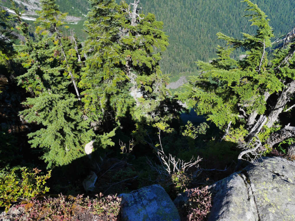
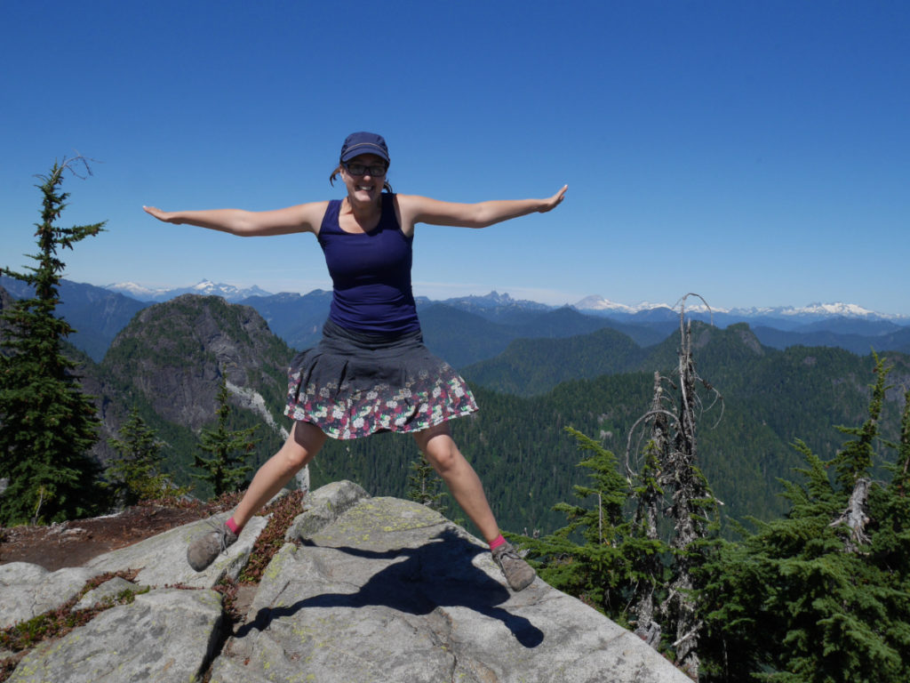
I loved the views in all directions! The most scary view was facing Northwest, where there is a STEEP cliff that drops the whole way down into the Hanes valley. I am always drawn to steep drops…but Marc would only take a jumping photo once I stepped away from the edge.

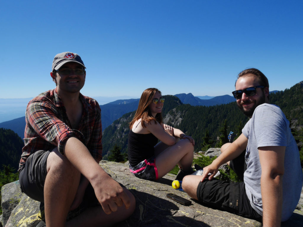
We ate our lunch looking in one direction, and then left our bags to keep exploring, there is quite a large area at the top of Goat Mountain. We wandered over to the highest point facing South, and were surprised to find one of Marc’s colleagues from London sitting on a rock with his girlfriend! They only just moved to Canada, so this was their first mountain climb of the summer – they certainly picked a good one!
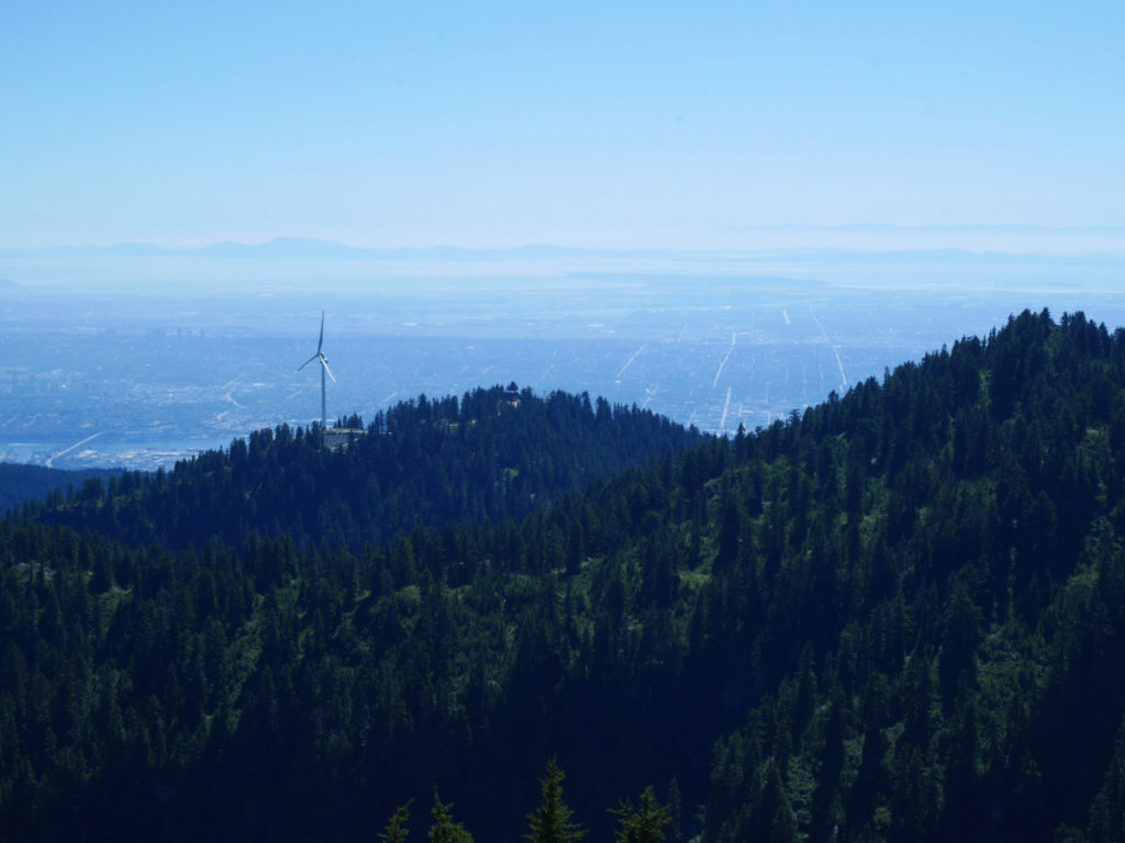
This is the view looking down to Dam Mountain and Grouse Mountain. We waved to Monty in the city below.
It was such a perfect, clear day that we could see the wall of mountains that separates Canada from the United States. Doesn’t Mount Baker look like a pretty place to explore!?

And so, after eating all our food, chatting with friends and taking a zillion photos, it was time to descend. We had plans to meet friends at the cinema, so we needed to walk back pretty speedily. The views were still breathtaking on the walk down. We were incredibly lucky with the clear skies, but these views would still be gorgeous with a little mist or clouds.
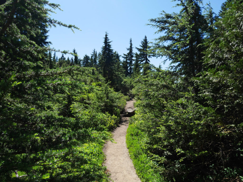
Once we made it back to the crossroads with Little Goat Mountain and Crown Mountain, we decided to take a new route back; Along the Alpine Trail. This meant we didn’t re-climb everything on the way home. BUT we still got to see some new pretty views through the trees.

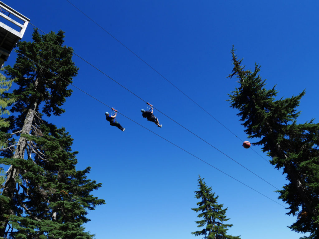
Eventually we made it back close to Grouse Mountain. You know when you’re getting close because you can hear the “whoops” from people zooming down the zip-lines between the mountains! Walking back was also faaar easier compared to our previous trek here through the snow.
The last moments before we arrived back at Grouse Mountain are just so beautiful. We could look down to the Strait of Georgia, which was sparkling in the sun. This section is really quiet, before you return to the crowds on Grouse Mountain.
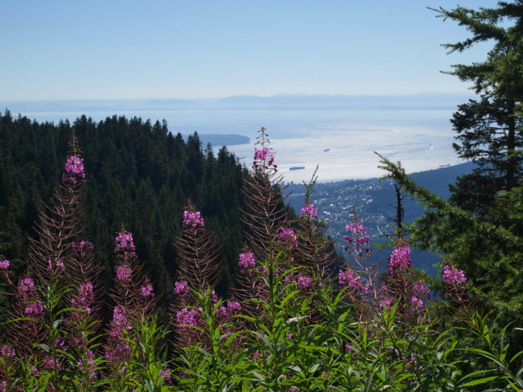
There were so, so many beautiful flowers! It was strange to see foxgloves still flowering; The ones in my English garden bloomed back in April, so these mountain flowers were a whole 4 months later!


When we arrived back on Grouse, the lines for the Skyride were ridiculous! Last time we waited 45 minutes for a ride down, but this time the line was more than twice as long! We had already paid for our tickets, and they wouldn’t refund them(!) How Rude! So, we gave them away to some girls at the top of the grind, and started walking back down the BCMC trail. By now there was more sun filtering through the forest so it was a gorgeous, if knee-busting descent.

We thought it would be quicker to come down. But as you have to be careful with tree roots, it still took us over an hour and a half to walk down.
On the way we made friends with a girl who was walking on her own. She had attempted to climb Crown Mountain but had met a black bear. She said as soon as she saw it, she forgot everything that she is meant to do, and screamed! Someone further down the trail shouted “don’t run” so she managed to stay still. Then, she also saw a baby bear! She had to back away slowly, and then climb back over up to Little Goat Mountain all alone. She was still a bit freaked out, so we chatted and walked down the mountain together to help calm her down. It turned out that she studies at UBC, so I made a new hiking friend.
So, that is the story of our walk to Goat Mountain. If you are visiting Vancouver, (and you have strong legs) I cannot recommend this hike enough. It was so, so fun! We walked for about 8 hours – but this included the 5km before we got to the mountain, as well as the 3.5 hours going up and down Grouse Mountain. So, if you take the Skyride you can probably do the whole walk in around 4 hours. Doooo it!
29 thoughts on “Vancouver Walks – Goat Mountain”
Wow! Those pictures are mind blowing! And Mount Baker does look so dreamy there off in the distance. I can’t hike; so I’m just gonna live vicariously through you now… minus the almost sliding off cliffs part (next one to read!) Happy hiking!
Thanks Jessica!
You could still go up to the top of Grouse Mountain in the Sky ride…and yay that you can still see all the views with my photos!
My mum used to be in a wheelchair, that is the main reason I always take so many photos. I got into the habit early as I’ve always wanted to share pretty views with her. I really love that more people are happy to see them too, so thank you so much for popping by!
Looks fantastic. So beautiful with all the flowers in bloom and the views look breathtaking.
Thanks George!
The views *were* breathtaking. It’s hard to show them off in photos but it was so fun to be right in the middle of s many mountains! It just made me want to explore more!!
I know that feeling!
Amazing hike! Haha I might sound silly but were there any goat sightings since it’s called goat mountain? I’d want to go zip lining there!
I was wondering why it’s called goat mountain too! I mean, I didn’t see any goats in Vancouver…so I’m not sure why it received that name!
The zip-lining looks sooo fun BUT it’s super pricey! Over $100, plus you have to pay to get up there! I’d love to, but I can’t quite justify it at that price! 🙁
Apparently it’s so named because someone shot a pair of mountain goats up there way back in 1894 🙂
Wow that is interesting for some reason I didn’t get a notification about this but thanks for sharing.
Also Josy I see you figured out the thing with the Pinterest pins and the resize. What was the solution?!
For some reason my blog hates pins that are ping files. I’ve slowly been making new pins for my older posts. 😀
What a wonderful post and, by the looks of the photos, a wonderful place to hike! Have you ever visited the North Shore of Lake Superior in Minnesota? There are hundreds of miles of hiking trails in a small area (waterfalls, overlooks, huge cliffs, and rivers). If you ever come this way, I’d be happy to direct you to some top-notch hikes! 🙂
I would LOVE that!
Most of our holidays will be for friends weddings in the next year, but after that we are both keen to explore further afield in North America and Canada and visit more mountains. I will give you a shout when we make plans for Minnesota!
1. That is a fantastic way to stay comfortable and dry, and I know quite a few people who could benefit from this tip!!
2. This hike is absolutely gorgeous, and I totally recommend that anyone who has an interest in hiking tackle Goat Mountain when they visit Van city! It’s also looking a little clearer, which is nice to see given all of the wildfires 🙁
3. Are you gonna head to Banff soon to get some hikes in there??
1. Yay! Please share the tip! It works really well.
2. The smoke came back last week (it was horrible again) …but it has cleared again a bit this week. 😀 That hike was amaaazing, but part of the reason we chose to do it was because of the clear weather.
3. YES! But I am not sure when! We didn’t even get as far as Whistler yet!
Your photos are beautiful, Josy. What an interesting hike – from yoga enthusiasts to bears. I would definitely want to see the bears enclosed and not in the wild like your hiking companion. Living in Maine I have a healthy respect for bears, especially mama bears protecting their young.
Yep, a mummy and baby bear is definitely the kind of bear I wouldn’t like to meet! At least the bears she saw were black bears, rather than grizzlies like Grinder and Coola.
What kind of bears do you get in Maine!?
Now you see why I rate this hike so highly 🙂 But – wow – did you ever do it the hard way hiking up and down the BCMC! Walking further along the ridge is really nice and you probably won’t encounter anyone else. It’s not as hard as the sign makes out – they’re to discourage the inexperienced/ill-prepared.
The red berries are probably rosy twistedstalk (look carefully at the berries and you’ll see why they get that name); the black ones look like black huckleberries – delicious and sweeter than blueberries.
Ah well. I missed them that time, but I can try them next time!! 🙂
You were right. This was an amaaaazing hike!
You should give me a shout one day when you’re in UBC. I feel like I owe you a coffee/beer for all your brilliant advice since we moved here. 🙂
Aww – only too happy to help out! 🙂 Yes, let’s do that – it would be nice to meet up 🙂 How about we wait a week or so to let the start-of-term craziness to die down at bit?
Sure 🙂
Let me know when you have a not-too-busy day. 😀
Wow, it’s a beautiful area. Thanks for the tour. Probably need a GPS, as well as a map for this walk.
You’d manage without GPS because it is a pretty obvious path and well sign posted. I always feel like GPS is more needed in really confusing areas with less obvious paths!!
You’re right but I have a habit of walking off the beaten track. LOL 🙂
I think my comment disappeared or went to your spam box. Thanks for the tour.
It’s here don’t worry! 😀
That’s for popping over! We’ve swapped mountain photos for the day as I LOVED your post today too.
Thanks!