
Mount Strachan Hike -Cypress Mountain Hikes
 Mount Strachan is one of the three Mountains that make up Cypress Bowl (and the Cypress Mountain Ski resort) near Vancouver, Canada. However, for some reason it receives far less attention than the other two, Black Mountain and Hollyburn Mountain. This trail involves hiking up a beautiful (if tiring) gully and then scrambling up to two peaks. Then, on the return journey you go past a airplane crash site before hiking through some truly gorgeous old growth forest. It really is a fantastic walk.
I’ve read that Mount Strachan it should be pronounced “strawn” but every time I have heard other hikers talk about it, they’ve pronounced it “straken.” So I am afraid I don’t have helpful advice for how to say this!
Mount Strachan Hike Map
Mount Strachan Hike – the basics
Distance: 10.5 km (or 6.9 km for a smaller loop)
Elevation Gain: 550m
Highest Point: 1459m
Time: 5.5 hours
What to bring: Walking boots, hiking poles and bug spray!
The 10 Essentials as always
Facilities: There are loos and a water fountain at the start/end of the hike in the lodge
Dog Friendly: Yes! But you should keep them on a leash.
How hard is it: Moderate. It’s not too technical, but you’ll need to pull yourself up through the trees at some points. It can also be difficult to find the route.
It is harder than the other options nearby: Hollyburn Mountain, St Marks and Black Mountain, but it’s a fun challenge. It’s nowhere near as exhausting as Unnecessary Mountain.
Hiking with Wanderung
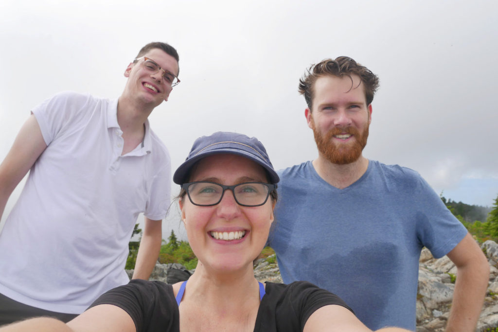
I have been on a few other hikes with Wanderung – click here to read about them or click here to sign up! Basically you can send a message to a list of 3000 enthusiastic hikers, and anyone that wants to join you will send you an e-mail and come out for a hike. This time, friendly blokes called James (from Canada) and Wout (from Belgium) decided to join me.
Start on the Howe Sound Crest Trail
We followed the trail as described by the 105 hikes book, so it starts by following the Howe Sound Crest Trail (HSCT) that we used to hike to Unnecessary Mountain and the Lions. We also took a mini detour because neither Wout or James had been to Bowen Lookout, so it is worth popping over there to see the view.

Christmas Gully
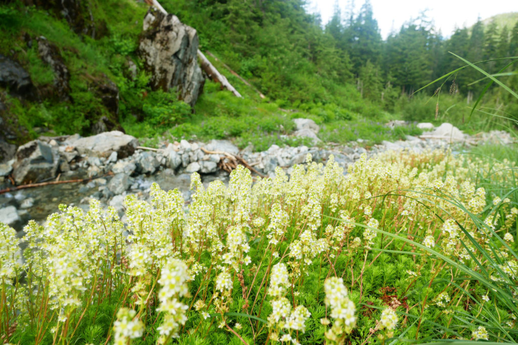
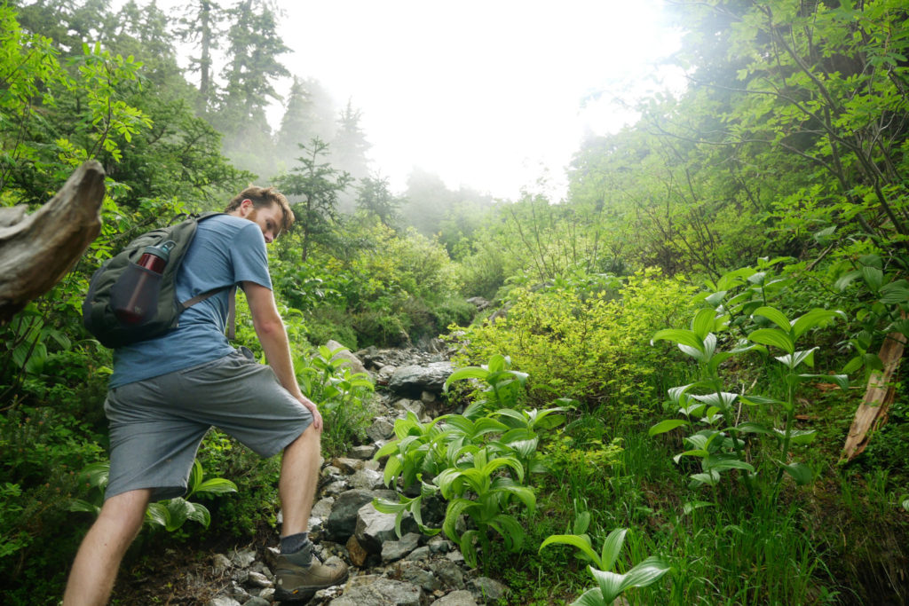
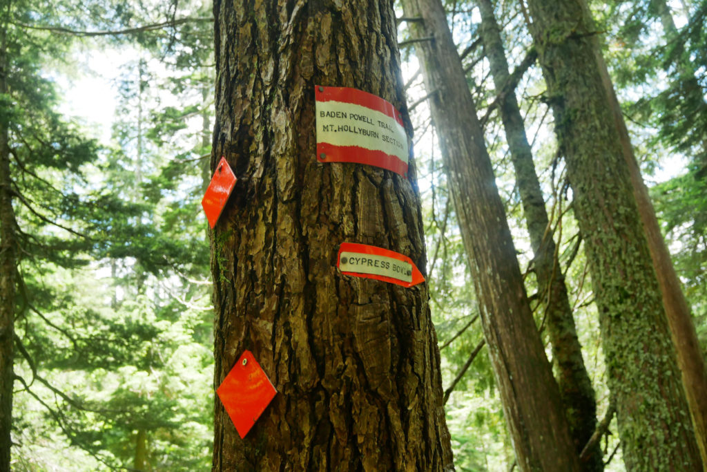
The path up Mount Strachan follows Christmas Gully, which is a turn off from the HSCT. The turning is quite difficult to spot (we walked straight past it!) However if you look to the right, between two bridges, you should be able to find it.

The trail is full of flowers and when we went it was pretty soggy. The dew-filled vegetation soaked my hiking trousers, but looked gorgeous. There aren’t many route markers, so you have to keep an eye out for footprints to find the path.
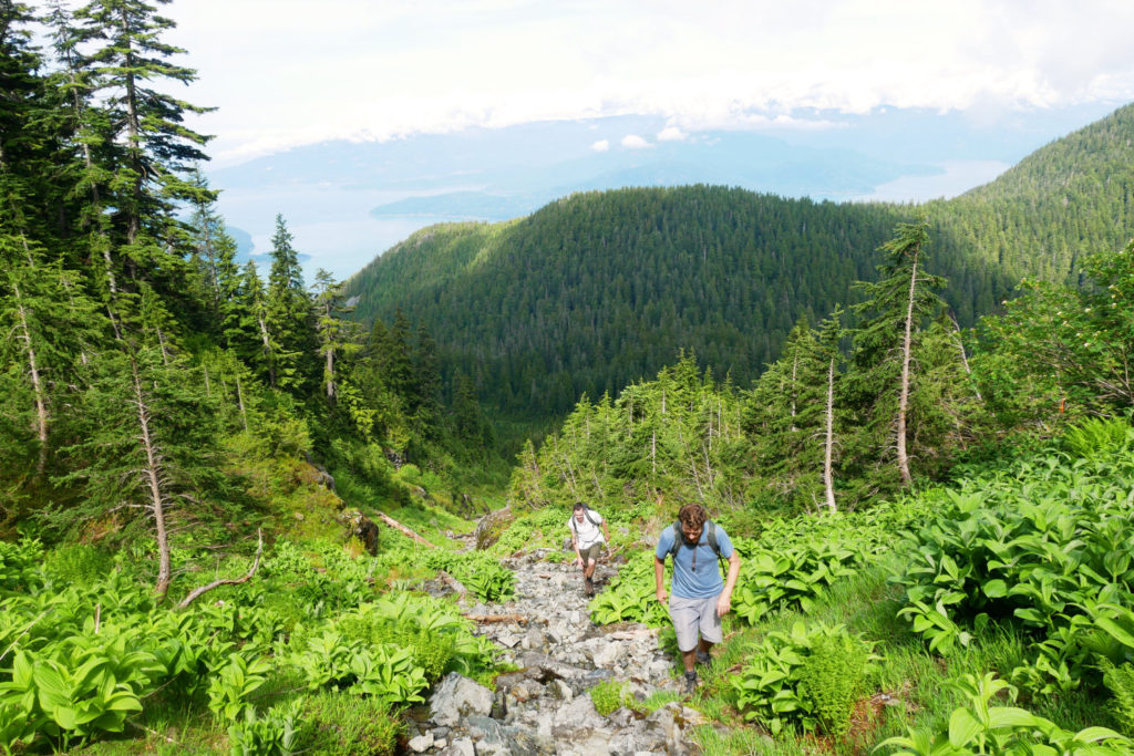
Trails through the trees
Once you reach a cliff, look left and follow the path into the trees. This is not well marked at all, and we thought we had lost the trail completely until I realized we need to pull ourselves up over a curved tree! After we’d found this hidden track the flagging improved, so we knew we were going the right way up Mount Strachan. Still, the trail is pretty wild (read-overgrown) so it was fun to fight our way through.
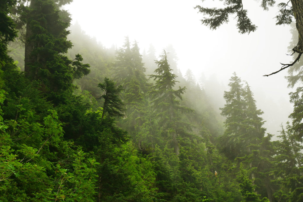
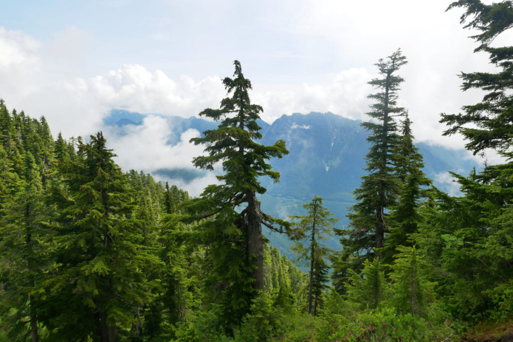
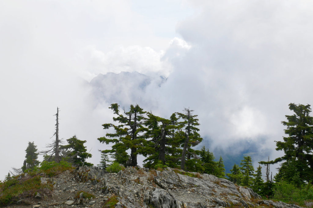
Misty Mountain
Just as we started to get close to the saddle between the two Mount Strachan peaks, the mist descended. Forests always look pretty cool in the mist, but it did mean we kept losing the epic views down to Howe Sound.
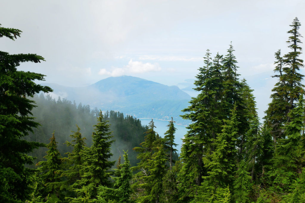
Mount Strachan North Peak – 1459m
We started by climbing up to the North Peak, despite the mist. I was hoping to get an epic view of the Lions but alas, all the mountains had disappeared completely. We met a super cute dog called Maggy and her human. We waited for a little while to see if the mist would lift, and we did get a few views East over towards Crown Mountain. But the Lion’s remained hidden.
We continued on to the South Peak. You have to scramble black to the saddle, then right back up again.

This is the view of the North Peak (when I was halfway up the next peak). You can see there isn’t a huge amount of prominence, but both peaks have steep trails to the top. Please note, all the routes to leave Mount Strachan go via the South Peak, so you do need to hike up the second, smaller peak.

The clouds started to lift to the East, so we did get some good views of the other North Shore Mountains.
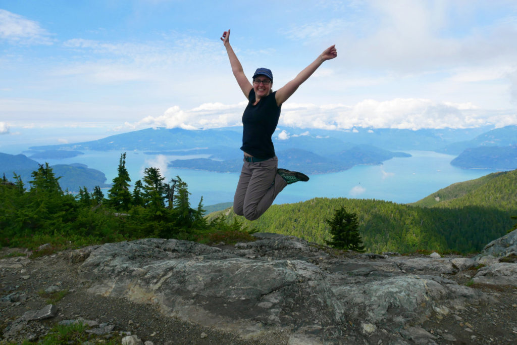
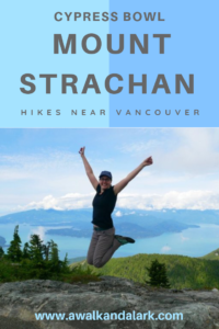
Mount Strachan South Peak – 1445m
We got views! The clouds were a little better once we reached the South Peak, so we could eat while looking out to Bowen Island and Howe Sound. Wout even took a jump shot for me *woot woot*. Unfortunately we couldn’t stay at the top for long because it was also lunchtime for mosquitoes, and they were buzzing around and biting us all.
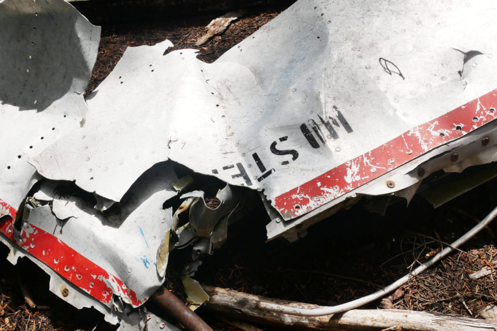
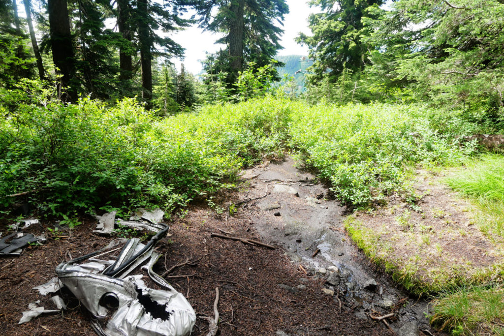
T-33 JET Crash Site
We found the Mount Strachan Trail to take us back down the mountain. This goes right through the crash site of a Royal Canadian Navy T-33 jet. It is quite surreal to find this jumble of jet wreckage within the peaceful forest.
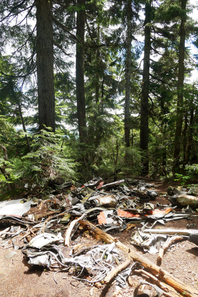
This site has been preserved as a site of historical interest, and there is a plaque explaining about it on a nearby tree. If you visit, please leave everything as you find it.
After the crash site, keep following the path down through the forest. Sometimes the path opens out by the ski runs or into (muddy) meadows. We spent a lot of time on Mount Strachan learning to ski, so I really enjoyed seeing the same views in the sunshine. Still, zooming down the mountain on skis is way faster than hiking down!
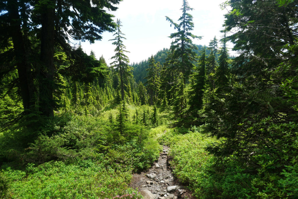
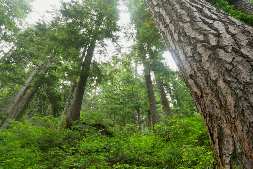
Mount Strachan Forest walk
The Mount Strachan trail (which then turns off onto the old Mount Strachan trail) is a pleasure to walk through. There is plenty of undergrowth (so I ended up with wet legs from all the soggy plants) but the trees are beautiful, and this part of the trail is not very steep. If you are short on time, you could easily hike down the Collins ski run, and skip this section of the walk.
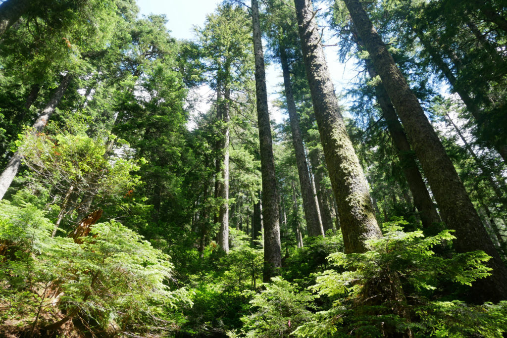
Baden Powell Trail back to Cypress Bowl
The final section of the hike is along the Baden Powell trail. It goes past more giant old growth trees and the floor is covered in roots that might trip you up. It’s a lovely end to a beautiful trail.
I hope you like the look of this hike up Mount Strachan. If you’re looking for other peak-bagging options in this area, i have a few other possibilities below:
- Hollyburn Mountain This is an easy-ish hike with gorgeous views down to Vancouver. You can even keep going and link this to the Mount Strachan hike.
- Black Mountain to Eagle Bluffs This is a fun trail that will allow you to swim in a tarn at the top.
- Unnecessary Mountain (or for easier walks, head to the Bowen Island Lookout, or St Marks Summit along the same trail
Click on the images below if you’d like to pin them.
25 thoughts on “Mount Strachan Hike -Cypress Mountain Hikes”
Wow, that jet crash memorial was surprising. I had no idea that was there!
I had read that it was close to the trail, but I hadn’t expected it to be *right* in the middle of the pathway!
I never understood why one of the ski runs was called T-33…now it makes sense…
Haha, i don’t know how to pronounce it either. It does get much less attention than Black Mountain and Hollyburn Peak,, and that’s a good thing as they are getting very busy. You got a great view, I had forgotten how nice it is; thanks for the reminder.
Yeah, we only saw three other hikers (and Maggie the dog) all day! But there are always crowds on top of Black Mountain! I think I’ll need to do this one again as Marc didn’t see it yet!
p.s. I am glad I’m not the only one who doesn’t know how to pronounce it!!
Your photos are beautiful. The landscape and view is amazing; would definitely love to visit there.
Thanks Nitin! I am so glad we had a bit of the view to share with you! 😉
Looks so nice! Love the wildflower shots, too. Interesting about the plane crash. While my family and I were vacationing in Ocean City, Maryland, recently, we saw where a pilot of a small plane had made a water landing that day–he survived–and by the next day it was investigated and gone.
Phew! Thank goodness he survived! That is pretty impressive that they cleared it away so fast!
The T-33 crashed back in the 60s when this area was less developed, so it was only much later when people could get up and visit the crash site. I guess by then it had become a historic site!
Not familiar with these mountains but they look like beautifu and a great place to hike. I do love a good scramble and a good jumping photo – good work!
This area is just North of Vancouver (I can see this mountain from my workplace on the edge of Vancouver) It means its a great mini adventure, just 30-40mins away from the city. It’s not quite as far off the beaten track as your epic posts!
I am not a big fan of hikers but I always enjoyed seeing your great find in your hiking experience! As always your photos are lovely and I love this when you jump with this stunning view at the background!
Thanks April! Maybe we’ll get you to like hikes more when your children are older!?
5 hours hike ! I’m not sure if I can do it ! The view from the top is gorgeous ! And your jump shot is perfect ! The crash site looks sad, I hope not many died in the crash ?
Yeah two people died (you can read more about it here: https://cypressmountain.com/latest-news/t33-plane-crash) it is really sad.
p.s. I bet you could do the hike. You could always cut off the hike through the forest and finish it in 4 hours.
So jealous! I live in the dry Madrid and I miss green landscapes like the one in your amazing pictures!
It’s funny you should say that. Whenever I have been hiking in Southern Europe, I am blown away by the beautiful landscapes, but after about a week I really miss the greenery. Living in a city with plenty of rain does have some up sides.
This looks amazing! I can’t wait until my little ones are big enough to conquer something like this with me. And the mist? It was beautiful. I’m sure a bit frustrating because of the views, but still it looks so mysterious.
Thanks Jen! Yeah, I do really love misty views too…I just get a little disappointing when we don’t see *anything.* This one might be a bit tough while your kids are small, but it’s be great for tweens or teens. 😉
Having said that, if you visit this area, the first lookout (called Bowen Lookout) has similar views, and the path is good enough to push a buggy…
Oh, this looks lovely! It reminds me a lot of the forests and mountains from back home, in Romania <3
Oooh nice, I have a feeling I`d LOVE Romania then. Plus you have castles as well as mountains and I always love castles!!
The place is just beautiful to visit, here are some great photos you have captured. Thanks for the share, will love to visit this place if I got chance.
Thanks Aparna!!
I love hikes and such green trails simply make me fall in love with. Cypress is a country that keeps on surprising with so much diversity.
Thanks Ansh! Although, this one is in Canada (rather than Cypress) It is just the surrounding area is called the Cypress bowl.
Lovely place to visit thanks for sharing.