
HBC (1849) Heritage Trail – Covile Camp
Our first Wilderness camping for 2021 was along the historical (and incredible) HBC (1849) Heritage Trail. We hiked from Sowaqua creek up to Covile Camp, and then continued on to Mason’s Ridge later. This hike involves gorgeous forest, challenging river crossings and what feels like real wilderness. It is perfect for days when you want to escape the crowds of busier trails. We didn’t see a single other hiker or camper the entire time.
This hike is listed in both Stephen Hui’s 105 Hikes aaand Taryn Eyton’s Backpacking in Southwestern British Columbia. If you don’t have those fab hiking books already, you should definitely check them out.

HBC (1849) Heritage Trail Map
This shows the section we did from Sowaqua Creek up to Covile Camp and Mason’s Creek. You can find a map to the entire HBC Heritage trail here.
HBC (1849) Heritage Trail to Covile Camp – the basics
Distance: 7.5 km to Covile Camp (15km return)
Elevation Gain: 300m
High Point: 930m
Time: 3 hours (5 hours return)
What to bring:
The 10 essentials, plus bug spray, bear spray and hiking poles (they help with creek crossings)
If you want to camp, you’ll want camping gear
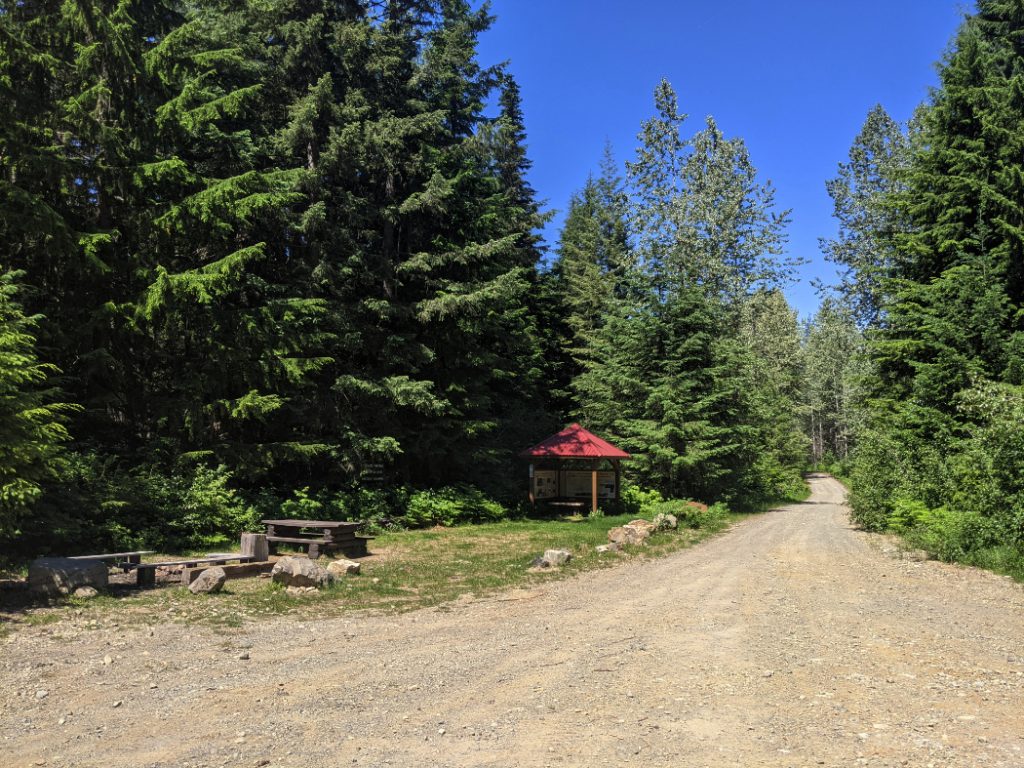
Facilities: Sowaqua Creek Campground has a loo, a bear cache and picnic benches.
Covile Campground has 3 tent pads, a picnic area, a loo and a bear cache.
Booking: You can’t book or reserve the campsites so we were worried it would be busy. We went on the weekend at the end of June and we were the only campers.
Dogs: Yep, dogs are welcome.
How hard is it? Intermediate, apart from the creek crossing, which can be difficult in the springtime. The hills feel hard with a backpack but I think it would be easier as a day hike.
Extra notes: I don’t think this would be good as a solo hike as there are so many creek crossings (where it is good to have a hiking partner.) If you do decide to do this solo, make sure you leave a good trip plan as there is no cell service in this area.

Historical trail
Marc and I first found out about this trail when we stopped to admire the view by the HBC trailhead near Hope last year. We had a read through the sign and both liked the sound of exploring this historical route. I love that each of the trailheads have signboards with information about it all. If you are a history nerd like me, take a look at the Hope Mountain Center’s page about the trail to read more. Last year we walked along the Hudson Bay Company’s earlier attempt to find a way across these mountains, the Tikwalus Heritage Trail. That steep route was so tough that 70 out of 400 horses died while attempting it.
The Hudson Bay Company (1849) trail lasted far longer, so I was hoping that meant it wouldn’t be quite as crazily steep as the Tikwalus trail.

Driving to Sowaqua Creek
To reach Sowaqua Creek, take exit 192 from the Coquihalla Highway, and drive down Sowaqua Creek FSR. I’ve heard this forest service road is sometimes in bad shape, but in 2021 it was fine. It is possible to drive the 20km to Sowaqua Creek with a 2WD vehicle but there are some bumpy sections and some very steep drop offs so drive slowly and carefully. The views from the road are pretty incredible!
Sowaqua Creek campground
After reading Taryn’s descriptions of this hike, we chose to start at Sowaqua Creek campground (rather than the traditional start of the hike). The camping area is slightly down the road from the actual trail with space to park, a loo, a bear cache and even picnic benches.
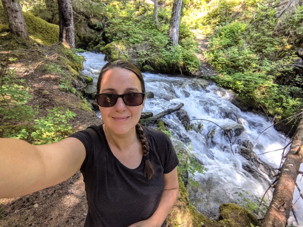
This was our first attempt at backpacking and camping in the wilderness for 2021. That is why I am looking so excited! I got Marc to take a photo of me before I got sweaty/muddy/stinky.

HBC Heritage Trail
This trail may have been built by the Hudson Bay Company back in 1849; But more recently it has been revived and maintained really well by a lots of volunteers (you can read more via Hope Mountain Center) Their hard work has really paid off. The trail is easy to follow with plenty of orange ribbons and red blazes to look out for along the way.


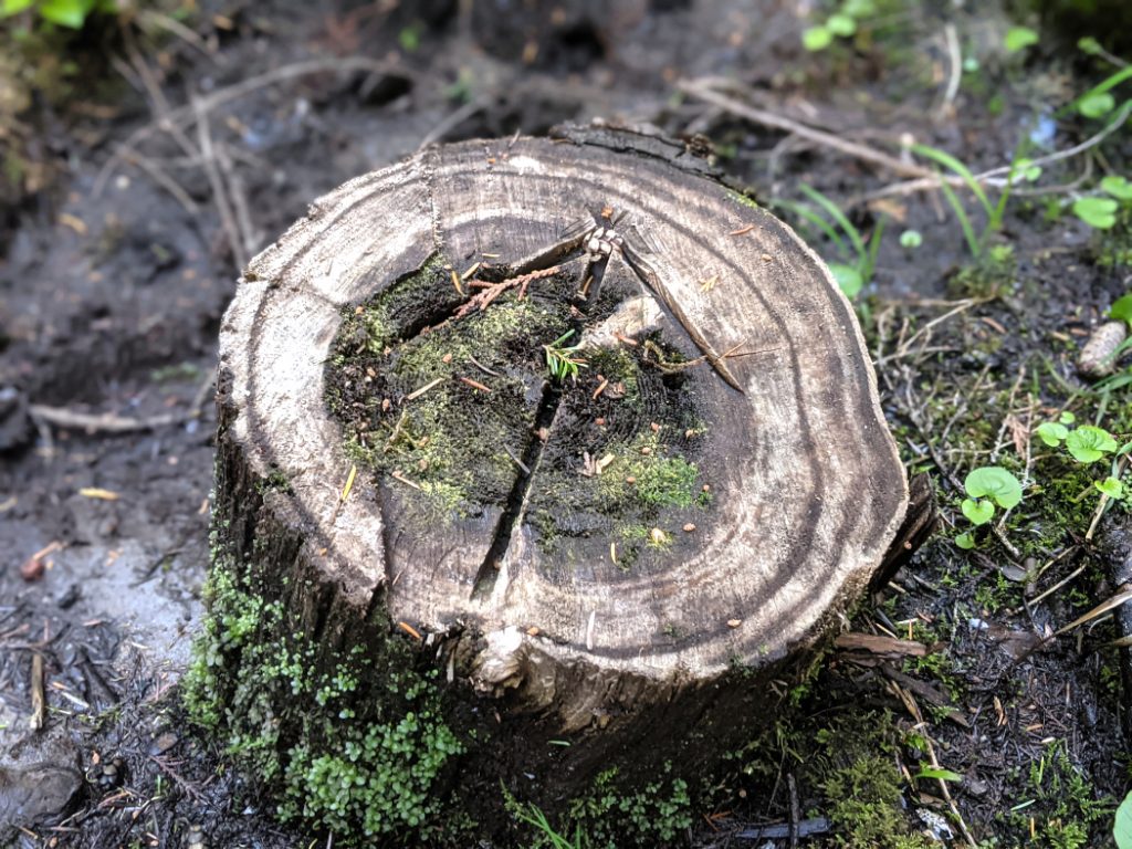
I loved some of the small details on this HBC trail; Like carved stumps to show you the way.
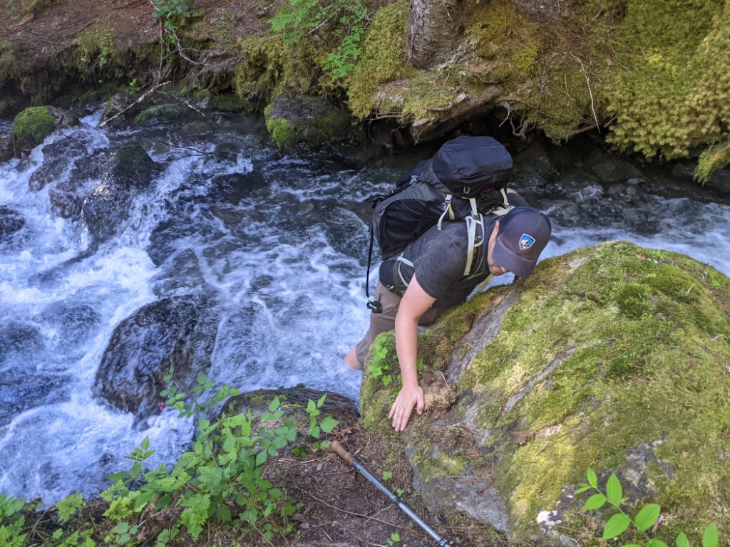
Creek crossings
One thing you need to be ready for is the creek crossings. We tackled the fast flowing sections together. If you need to do this, face up the river, in a line (with the strongest person at the front, taking the brunt of the flow.) Or, if the current is not strong, you can go one at a time, using your hiking poles to help you balance. The water is cold, but it can be pretty refreshing on a hot day.

In the springtime, the creeks were raging. They get worse the later in the day you attempt to cross them. These photos are from the same creek crossing, one at 9am, one at 10:30am. It was a LOT stronger in the afternoon. If you know you’ll be crossing creeks, start early.
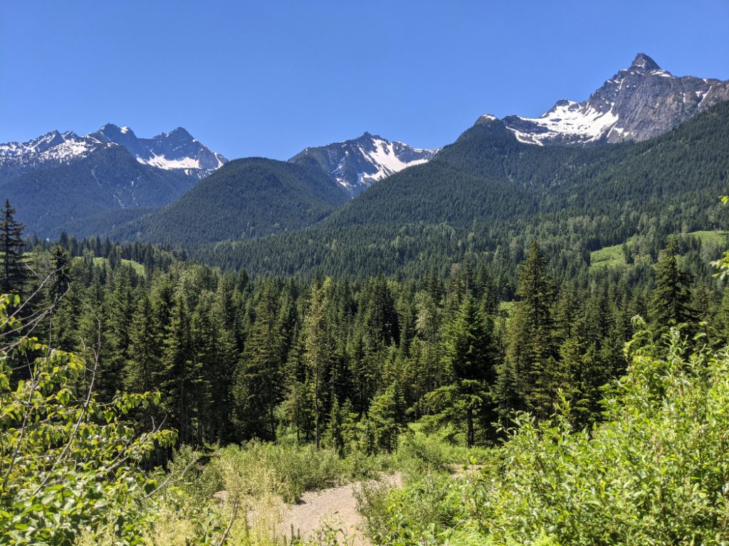
Most of the trail goes through the forest, but on a few occasions it opens out so you can see the incredible scenery of the Cascade wilderness.

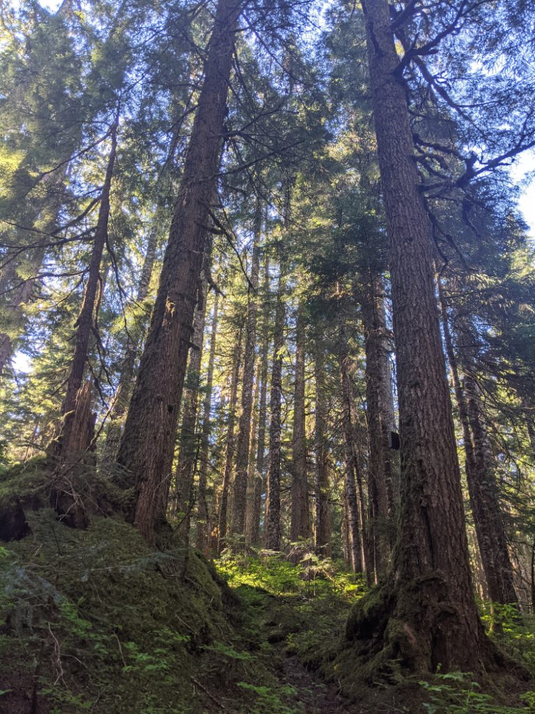
Climb through the forest
Once you’ve crossed the first two bridge-less creeks, you get to hike up a hill through the forest. This is the main time when you need to gain some elevation. After this you’ll be hiking along an undulating path, rather than just uphill.

Skunk Cabbage section
One part of the trail must have had snow very recently as the ground was muddy and there was plenty of skunk cabbage in bloom. This is the one area where you might lose the trail, as it is hard to follow the right way when everything is muddy.


Be bear aware!
We may not have seen other hikers along this trail, but there were signs of fuzzy dudes in the area. We did see a bear later (from afar.) He ran off as soon as he caught a whiff of us. If you hike here, be sure to make plenty of noise while you hike, so you don’t surprise a bear.

There is a forest service road the crosses the trail, so you get another peek-a-boo view of the surrounding mountains.

We were getting a bit hot in the final section, but at least it is all in the forest, and mostly downhill before you reach Covile campground. There is one more creek crossing before you reach the camping area; But a fallen log makes a perfect bridge, so you don’t need to get your feet wet again.


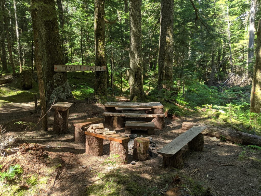
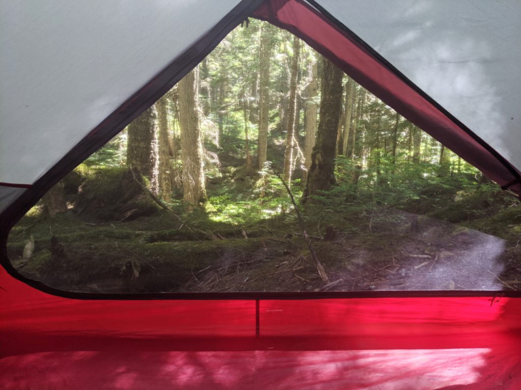
Covile Campground
Covile campground itself is lovely! It sits in between two small creeks (one you can jump over, the other has the log that acts as a bridge.) This is not one of the historical campsites for the HBC (1849) Heritage Trail, but it is a really pleasant addition to the original route. The tent pads all have pretty forest views and there is a nice cooking/eating area in the center.
This was the tent pad we chose. Not a bad place to camp eh!?

This is just to give you an idea about the facilities. There are two lockers for a bear cache, and each of the tent pads is wide, flat and has plenty of space, even for a large tent like ours.


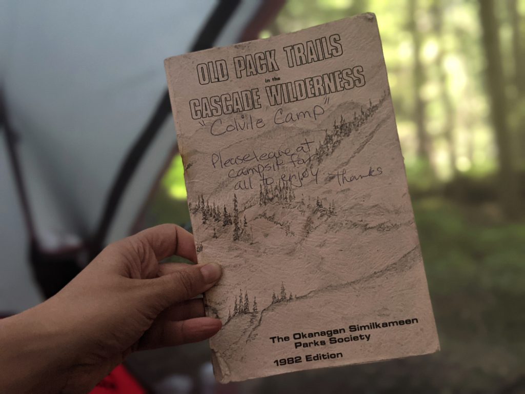
If you have a look in the lockers, there is a really cool guide to the historical trails in the area.
We did this hike when Canada was incredibly hot (in the news, they called it the “heat dome”) We made it to the campground by noon, but it was so hot that we decided to put up the tent and relax for a few hours, rather than hiking any further. Once the sun set, the temperature was really pleasant here. The campsite is over 900m up, so you need to bring some warm clothes for night time, even in summer.
Later that afternoon, we stashed our cooking things and food in the bear cache and hiked up to Mason’s Ridge. I’ll write about that part of the hike later as this is already a bit long!

We loved the HBC Heritage trail to Covile Camp. The small amount of elevation gain felt like a challenge for our first backpacking trip of the year; So it was great for getting us ready for the epic adventures we’ve done since then. The trail itself was well maintained and pleasant and I am still surprised by how few hikers there were! This isn’t really a “secret” hike as it’s in two of my favourite hiking guides. In any case I totally recommend it both as a backpacking adventure, or as a day hike.
Do you fancy this hike to Covile Camp? You can click on the pins below to save them for later.

41 thoughts on “HBC (1849) Heritage Trail – Covile Camp”
Eeeeepppppp oh my gosh that bear paw print
It’s cool to see isn’t it! Do you guys have lots of bears on your side of Canada too? I am always so excited to see them from afar!
I’m definitely a history nerd like you so this trail sounds ideal for me! It’s great that it only takes around 3hrs to hike around, and it looks very pretty too.
Thanks Krista! Yay for history nerds that like to walk 😀
Love the camp! It’s really neat to see the carved stumps to show you the way and the bear print definitely keeps you aware of your surroundings!
Thanks Chelsea! Yeees, seeing that paw print made us even better at shouting “hey bear” every so often!
In these past years, we have all discovered new spots for outdoor fun. Your hike on the HBC Heritage Trail sounds like a lovely escape. We are always looking for less busy trails and this sounds like just the spot. The one thing that might be a challenge for me would be the creek crossing. Good reason to not visit in the spring.
I have a feeling they would be easier normally – we just chose such a hot weekend in the spring.
You’re right though, one upside of the pandemic is people getting outside and finding lovely trails.
Oooh, I love all of your photos! I can’t wait to travel again – BC is the first place I’ll be going to!
Oh yay Amy! I hope you can soon. The borders are at least now open if you’re full vaccinated… but I guess it is better to wait for the fires to die down.
I love exploring historic trails too. Believe it or not, we have history filled trails here in HK. But at least we don’t have to deal with bears here though!
I swear I would’ve turned back straight away after seeing that paw print. I can deal with snakes, but bears are such an unknown for me.
It’s so funny I am getting to be the opposite. I don’t mind garter snakes, but anything poisonous would have me running away!
Bears are normally fine as long as you make plenty of noise and keep your distance. I was really worried about hiking in bear areas when we first got to Canada – but they are such cool dudes (who don’t want to be near humans) so now I love seeing them from afar.
Wow what a beautiful trail! It definitely looks difficult at some parts, especially where you have to cross water! You definitely seem quite prepared!
Thanks Nina!
I think it would be a pretty easy trail on a day hike (apart from the crossings) but yeah, I found the hills hard when lugging up my camping gear!
What a beautiful trail! I love the arrows carved into tree stumps – that’s so cute (and helpful!) I’m not so keen on the grizzly activity though! I wouldn’t know what to do if we encountered a bear!
What a gorgeous hike! I’ve never heard about creeks running faster later in the day. Do you know why that would be? Was there rain upstream? Just curious. This looks like a wonderful trip. BC is such a beautiful area.
Ooh sorry, I should have explained that! It was because it was really hot (and there was still lots of snow higher in the mountains.)
The snow melts more as the day goes on; So the creeks and river currents get stronger. We noticed it quite a lot this spring as the weather was hotter than normal.
Wow this is incredible! I love how you tell us about how hard it is, and what to expect. What a beautiful place and how lucky it wasn’t busy when you went. Just incredible that you spotted a bear print too! I grew up on a farm and I have memories of bears walking through our back garden to get to the blackberry bushes. Great post. Thanks for sharing!
Heh! Later that day we saw the bear too! I didn’t get a photo as he ran off as soon as we saw him.
That must have been soooo cool to see bears in your garden! <3
This sounds like a great hike! However, I’m not sure about the creek crossing!
I know what you mean, that was the intimidating part. It was pretty cool though.
I definitely agree with your recommendation and wouldn’t want to do this in the springtime with the crossing of the creek. I can imagine it would be slippery and likely muddy. But it’s definitely a pretty one in the summer and fall.
Thanks Renee! You’re right it’d be fab later in the year.
Every time I hear you mention a potential bear it scares me and thrills me at the same time. Good to know about the creek crossings and to be careful if doing solo. Great tips.
Thanks Kerry!
I know what you mean. I was so worried about bears when I first got here. They don’t like being near humans so if you make plenty of noise, they stay away.
omg that bear paw print is HUGE! that sounds like such an amazing hike! It’s longer than most hikes I go on, but it’s so pretty that I would really like to go on it one day!
Thanks Kate. You could totally manage it! 🙂
This seems like such a neat trail, and the picture of the bear paw print was so cool (and a lil scary) !
Riiight! It was such a good print too.
Wow!!! What a gorgeous hike!! I, too, loved the carved arrows in the old tree stumps to show the way. The bear tracks, on the other hand, would have made me a bit nervous. Beautiful pics!
Thanks Ildiko. 🙂
Another gorgeous hiking experience! Would love to hike HBC (1849) Heritage Trail to Covile Camp.
Thanks Karen. 😀
Awesome landscapes. There are so few wilderness areas now. We need to protect them.
This is so awesome! I’ve recently been doing more hiking, but it’s so different in Florida than in Canada. For instance, I try NOT to make any noise so I can see more wildlife. In most campgrounds we also don’t have bear caches though I’m sure in there are some in the more primitive campgrounds in the forests. And we don’t have have tent pads. So interesting! Looks stunning there!
I love the arrow carved into the stump. My husband and I have done a lot of hiking over the past year and have found it a great way to enjoy nature, social distance, and get some great photos.
Yeees I totally agree. I find it can really help to get outside to escape the madness of the last year!
Looks like a great hike next time we’re in Canada.
The campsite looks awesome! I don’t know that I’d be able to go on this hike since I pretty much only hike solo, but hopefully one day! That fact about the horses is really sad, too. Very interesting trail and history!
Oh my gosh what a beautiful camp site and trail and I can’t believe that you had the whole place to yourself in July!
… To finish my comment… (I hit enter too early). That’s so cool you got to see the bear tracks too. I always love finding signs of some animals, while keeping my distance from them. It looks like such a lovely trail and a great way to get started with your wild camping for 2021!